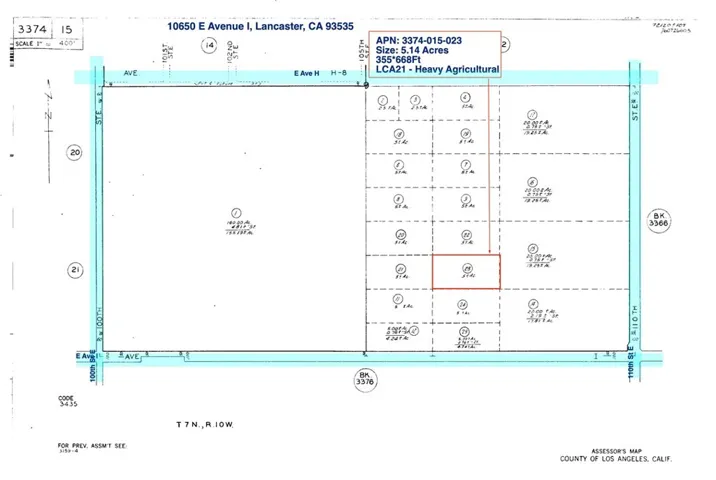
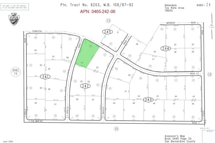
array:2 [ "RF Query: /Property?$select=ALL&$orderby=ListPrice DESC&$top=12&$skip=91980&$filter=(StandardStatus in ('Active','Active Under Contract')) and (PropertyType eq 'Residential' OR PropertyType eq 'Land' OR PropertyType eq 'Business Opportunity' OR PropertyType eq 'Commercial Sale' OR PropertyType eq 'Residential Income')/Property?$select=ALL&$orderby=ListPrice DESC&$top=12&$skip=91980&$filter=(StandardStatus in ('Active','Active Under Contract')) and (PropertyType eq 'Residential' OR PropertyType eq 'Land' OR PropertyType eq 'Business Opportunity' OR PropertyType eq 'Commercial Sale' OR PropertyType eq 'Residential Income')&$expand=Media/Property?$select=ALL&$orderby=ListPrice DESC&$top=12&$skip=91980&$filter=(StandardStatus in ('Active','Active Under Contract')) and (PropertyType eq 'Residential' OR PropertyType eq 'Land' OR PropertyType eq 'Business Opportunity' OR PropertyType eq 'Commercial Sale' OR PropertyType eq 'Residential Income')/Property?$select=ALL&$orderby=ListPrice DESC&$top=12&$skip=91980&$filter=(StandardStatus in ('Active','Active Under Contract')) and (PropertyType eq 'Residential' OR PropertyType eq 'Land' OR PropertyType eq 'Business Opportunity' OR PropertyType eq 'Commercial Sale' OR PropertyType eq 'Residential Income')&$expand=Media&$count=true" => array:2 [ "RF Response" => Realtyna\MlsOnTheFly\Components\CloudPost\SubComponents\RFClient\SDK\RF\RFResponse {#7613 +items: array:12 [ 0 => Realtyna\MlsOnTheFly\Components\CloudPost\SubComponents\RFClient\SDK\RF\Entities\RFProperty {#7622 +post_id: "35164" +post_author: 1 +"ListingKey": "1107497693" +"ListingId": "OC25038339" +"PropertyType": "Land" +"StandardStatus": "Active" +"ModificationTimestamp": "2025-04-25T22:29:23Z" +"RFModificationTimestamp": "2025-04-25T22:37:35.191370+00:00" +"ListPrice": 17000.0 +"BathroomsTotalInteger": 0 +"BathroomsHalf": 0 +"BedroomsTotal": 0 +"LotSizeArea": 9583.0 +"LivingArea": 0 +"BuildingAreaTotal": 0 +"City": "Blythe" +"PostalCode": "92225" +"UnparsedAddress": "0 Wells Rd, Blythe, California 92225" +"Coordinates": array:2 [ 0 => -114.607297 1 => 33.604563 ] +"Latitude": 33.604563 +"Longitude": -114.607297 +"YearBuilt": 0 +"InternetAddressDisplayYN": true +"FeedTypes": "IDX" +"ListAgentFullName": "Brandy Cox" +"ListOfficeName": "Blackbird Real Estate Group" +"ListAgentMlsId": "OCCOXBRAND" +"ListOfficeMlsId": "0C07544" +"OriginatingSystemName": "CRMLS" +"PublicRemarks": "This lot is well positioned for access with power nearby and within the city limits of Blythe. It is zoned General Commercial and all interested buyers should check with the city building department for usage prior to purchase. The lot does not currently have an address, one will be assigned by the City of Blythe when development occurs." +"AttributionContact": "760-989-9272" +"CommonInterest": "None" +"CommunityFeatures": "Curbs" +"ContractStatusChangeDate": "2025-02-20" +"Country": "US" +"CountyOrParish": "Riverside" +"CreationDate": "2025-03-08T15:31:49.123798+00:00" +"CumulativeDaysOnMarket": 64 +"DaysOnMarket": 141 +"DaysOnMarketReplication": 64 +"DaysOnMarketReplicationDate": "2025-04-25" +"DaysOnMarketReplicationIncreasingYN": true +"Directions": "From Blackbird office: Drive south on Broadway to 14th Ave and right. Drive west to Lovekin Ave and turn right. Turn left at Wells Rd and S. Solano" +"DistanceToWaterComments": "50 ft" +"ElevationUnits": "Feet" +"RFTransactionType": "For Sale" +"InternetAutomatedValuationDisplayYN": true +"InternetConsumerCommentYN": true +"InternetEntireListingDisplayYN": true +"ListAgentAOR": "Orange County" +"ListAgentEmail": "brandy@coxlandco.com" +"ListAgentFirstName": "Brandy" +"ListAgentKey": "18296985" +"ListAgentKeyNumeric": "18296985" +"ListAgentLastName": "Cox" +"ListAgentOfficePhone": "949-690-8676" +"ListAgentStateLicense": "02065223" +"ListOfficeAOR": "Orange County" +"ListOfficeEmail": "kim@blackbirdrealestategroup.com" +"ListOfficeKey": "3255467" +"ListOfficeKeyNumeric": "3255467" +"ListOfficePhone": "949-690-8676" +"ListingAgreement": "Exclusive Right To Sell" +"ListingContractDate": "2025-02-20" +"ListingKeyNumeric": 1107497693 +"ListingService": "Full Service" +"ListingTerms": "Cash,1031 Exchange,Submit" +"LotFeatures": "0-1 Unit/Acre" +"LotSizeAcres": 0.22 +"LotSizeSource": "Assessor" +"LotSizeSquareFeet": 9583.0 +"MLSAreaMajor": "374 - Blythe" +"MajorChangeTimestamp": "2025-04-25T15:05:28Z" +"MajorChangeType": "Price Change" +"MlsStatus": "Active" +"OnMarketDate": "2025-02-20" +"OnMarketTimestamp": "2025-02-20T15:05:26Z" +"OriginalEntryTimestamp": "2025-02-20T15:05:26Z" +"OriginalListPrice": 18000.0 +"OriginatingSystemID": "CRM" +"OriginatingSystemKey": "373969797" +"OriginatingSystemSubName": "CRMLS_CRM" +"ParcelNumber": "836144004" +"PhotosChangeTimestamp": "2025-02-20T23:41:55Z" +"PhotosCount": 3 +"PreviousListPrice": 18000.0 +"PriceChangeTimestamp": "2025-04-25T15:05:28Z" +"ShowingContactType": "Agent" +"SourceSystemID": "TRESTLE" +"SourceSystemKey": "1107497693" +"SpecialListingConditions": "Standard" +"StateOrProvince": "CA" +"StatusChangeTimestamp": "2025-02-20T15:05:26Z" +"StreetName": "Wells Rd" +"StreetNumber": "0" +"SubdivisionName": "none" +"TaxLot": "17" +"UniversalPropertyId": "US-06065-N-836144004-R-N" +"View": "None" +"WaterSource": "See Remarks" +"Zoning": "R2" +"CustomFields": """ {\n "AdminUpdateYN": "0",\n "ListingKey": "1107497693"\n } """ +"HumanModifiedYN": false +"LeaseAmountPerAreaUnit": "Dollars Per Square Foot" +"@odata.id": "https://api.realtyfeed.com/reso/odata/Property('1107497693')" +"CurrentPrice": 17000.0 +"provider_name": "CRMLS" +"RecordSignature": 898169462 +"UniversalParcelId": "urn:reso:upi:2.0:US:06065:836144004" +"CountrySubdivision": "06065" +"OriginatingSystemListOfficeKey": "355067865" +"OriginatingSystemListAgentMemberKey": "365217485" +"Media": array:3 [ 0 => array:58 [ "Order" => 1 "ImageOf" => null "ListAOR" => null "MediaKey" => "2003812654030" "MediaURL" => "https://dx41nk9nsacii.cloudfront.net/cdn/3/1107497693/7f301543133c1e87e63dc952d62a971f.webp" "ClassName" => null "MediaHTML" => null "MediaSize" => 244386 "MediaType" => "webp" "Thumbnail" => "https://dx41nk9nsacii.cloudfront.net/cdn/3/1107497693/thumbnail-7f301543133c1e87e63dc952d62a971f.webp" "ImageWidth" => null "Permission" => null "ImageHeight" => null "MediaStatus" => null "SyndicateTo" => null "ListAgentKey" => "18296985" "PropertyType" => "Land" "ResourceName" => "Property" "ListOfficeKey" => "3255467" "MediaCategory" => null "MediaObjectID" => "0.jpg" "OffMarketDate" => null "X_MediaStream" => null "SourceSystemID" => "TRESTLE" "StandardStatus" => "Active" "HumanModifiedYN" => false "ListOfficeMlsId" => "0C07544" "LongDescription" => null "MediaAlteration" => null "MediaKeyNumeric" => 2003812654030 "PropertySubType" => null "RecordSignature" => -762460472 "PreferredPhotoYN" => null "ResourceRecordID" => "OC25038339" "ShortDescription" => null "SourceSystemName" => null "ChangedByMemberID" => null "ListingPermission" => null "PermissionPrivate" => null "ResourceRecordKey" => "1107497693" "ChangedByMemberKey" => null "MediaClassification" => "PHOTO" "OriginatingSystemID" => "CRM" "ImageSizeDescription" => null "SourceSystemMediaKey" => null "ModificationTimestamp" => "2025-02-20T23:40:43.760-00:00" "OriginatingSystemName" => "CRMLS" "MediaStatusDescription" => null "OriginatingSystemSubName" => "CRMLS_CRM" "ResourceRecordKeyNumeric" => 1107497693 "ChangedByMemberKeyNumeric" => null "OriginatingSystemMediaKey" => "373969797" "PropertySubTypeAdditional" => null "MediaModificationTimestamp" => "2025-02-20T23:40:43.760-00:00" "SourceSystemResourceRecordKey" => null "InternetEntireListingDisplayYN" => true "OriginatingSystemResourceRecordId" => null "OriginatingSystemResourceRecordKey" => "373969797" ] 1 => array:58 [ "Order" => 2 "ImageOf" => null "ListAOR" => null "MediaKey" => "2003812653781" "MediaURL" => "https://dx41nk9nsacii.cloudfront.net/cdn/3/1107497693/1c7ed5a2b386c48074451021d8d359e2.webp" "ClassName" => null "MediaHTML" => null "MediaSize" => 276584 "MediaType" => "webp" "Thumbnail" => "https://dx41nk9nsacii.cloudfront.net/cdn/3/1107497693/thumbnail-1c7ed5a2b386c48074451021d8d359e2.webp" "ImageWidth" => null "Permission" => null "ImageHeight" => null "MediaStatus" => null "SyndicateTo" => null "ListAgentKey" => "18296985" "PropertyType" => "Land" "ResourceName" => "Property" "ListOfficeKey" => "3255467" "MediaCategory" => null "MediaObjectID" => "1.jpg" "OffMarketDate" => null "X_MediaStream" => null "SourceSystemID" => "TRESTLE" "StandardStatus" => "Active" "HumanModifiedYN" => false "ListOfficeMlsId" => "0C07544" "LongDescription" => null "MediaAlteration" => null "MediaKeyNumeric" => 2003812653781 "PropertySubType" => null "RecordSignature" => -762460472 "PreferredPhotoYN" => null "ResourceRecordID" => "OC25038339" "ShortDescription" => null "SourceSystemName" => null "ChangedByMemberID" => null "ListingPermission" => null "PermissionPrivate" => null "ResourceRecordKey" => "1107497693" "ChangedByMemberKey" => null "MediaClassification" => "PHOTO" "OriginatingSystemID" => "CRM" "ImageSizeDescription" => null "SourceSystemMediaKey" => null "ModificationTimestamp" => "2025-02-20T23:40:43.760-00:00" "OriginatingSystemName" => "CRMLS" "MediaStatusDescription" => null "OriginatingSystemSubName" => "CRMLS_CRM" "ResourceRecordKeyNumeric" => 1107497693 "ChangedByMemberKeyNumeric" => null "OriginatingSystemMediaKey" => "373969797" "PropertySubTypeAdditional" => null "MediaModificationTimestamp" => "2025-02-20T23:40:43.760-00:00" "SourceSystemResourceRecordKey" => null "InternetEntireListingDisplayYN" => true "OriginatingSystemResourceRecordId" => null "OriginatingSystemResourceRecordKey" => "373969797" ] 2 => array:58 [ "Order" => 3 "ImageOf" => null "ListAOR" => null "MediaKey" => "2003812653913" "MediaURL" => "https://dx41nk9nsacii.cloudfront.net/cdn/3/1107497693/93d9aafbadd87e0ec8e238747fcc7f91.webp" "ClassName" => null "MediaHTML" => null "MediaSize" => 250206 "MediaType" => "webp" "Thumbnail" => "https://dx41nk9nsacii.cloudfront.net/cdn/3/1107497693/thumbnail-93d9aafbadd87e0ec8e238747fcc7f91.webp" "ImageWidth" => null "Permission" => null "ImageHeight" => null "MediaStatus" => null "SyndicateTo" => null "ListAgentKey" => "18296985" "PropertyType" => "Land" "ResourceName" => "Property" "ListOfficeKey" => "3255467" "MediaCategory" => null "MediaObjectID" => "2.jpg" "OffMarketDate" => null "X_MediaStream" => null "SourceSystemID" => "TRESTLE" "StandardStatus" => "Active" "HumanModifiedYN" => false "ListOfficeMlsId" => "0C07544" "LongDescription" => null "MediaAlteration" => null "MediaKeyNumeric" => 2003812653913 "PropertySubType" => null "RecordSignature" => -762460472 "PreferredPhotoYN" => null "ResourceRecordID" => "OC25038339" "ShortDescription" => null "SourceSystemName" => null "ChangedByMemberID" => null "ListingPermission" => null "PermissionPrivate" => null "ResourceRecordKey" => "1107497693" "ChangedByMemberKey" => null "MediaClassification" => "PHOTO" "OriginatingSystemID" => "CRM" "ImageSizeDescription" => null "SourceSystemMediaKey" => null "ModificationTimestamp" => "2025-02-20T23:40:43.760-00:00" "OriginatingSystemName" => "CRMLS" "MediaStatusDescription" => null "OriginatingSystemSubName" => "CRMLS_CRM" "ResourceRecordKeyNumeric" => 1107497693 "ChangedByMemberKeyNumeric" => null "OriginatingSystemMediaKey" => "373969797" "PropertySubTypeAdditional" => null "MediaModificationTimestamp" => "2025-02-20T23:40:43.760-00:00" "SourceSystemResourceRecordKey" => null "InternetEntireListingDisplayYN" => true "OriginatingSystemResourceRecordId" => null "OriginatingSystemResourceRecordKey" => "373969797" ] ] +"ID": "35164" } 1 => Realtyna\MlsOnTheFly\Components\CloudPost\SubComponents\RFClient\SDK\RF\Entities\RFProperty {#7620 +post_id: "184429" +post_author: 1 +"ListingKey": "1119101060" +"ListingId": "SB25156485" +"PropertyType": "Land" +"StandardStatus": "Active" +"ModificationTimestamp": "2025-07-12T01:12:39Z" +"RFModificationTimestamp": "2025-07-12T02:06:03.575044+00:00" +"ListPrice": 17000.0 +"BathroomsTotalInteger": 0 +"BathroomsHalf": 0 +"BedroomsTotal": 0 +"LotSizeArea": 223687.0 +"LivingArea": 0 +"BuildingAreaTotal": 0 +"City": "Lancaster" +"PostalCode": "93535" +"UnparsedAddress": "10650 E Ave I, Lancaster, California 93535" +"Coordinates": array:2 [ 0 => -117.941 1 => 34.707 ] +"Latitude": 34.707 +"Longitude": -117.941 +"YearBuilt": 0 +"InternetAddressDisplayYN": true +"FeedTypes": "IDX" +"ListAgentFullName": "Emily Lin" +"ListOfficeName": "Equity Union" +"ListAgentMlsId": "SBLINEMIL" +"ListOfficeMlsId": "sb1385470" +"OriginatingSystemName": "CRMLS" +"PublicRemarks": "Expansive skies, open land, and mountain views define this 5.13-acre parcel in East Lancaster. Situated north of Avenue J and west of 110th Street East, this flat, rectangular lot is ideal for buyers seeking privacy, space, and possibility. Zoned LCA21 for heavy agricultural use, this is a rare opportunity to own over five acres at an accessible price, perfect for a future homesite, farming, or weekend retreat." +"AttributionContact": "310-751-4137" +"CLIP": 6788599675 +"CommonInterest": "None" +"CommunityFeatures": "Biking, Rural" +"ContractStatusChangeDate": "2025-07-11" +"Country": "US" +"CountyOrParish": "Los Angeles" +"CreationDate": "2025-07-12T02:05:56.349288+00:00" +"CurrentFinancing": "None" +"DaysOnMarketReplicationDate": "2025-07-12" +"DaysOnMarketReplicationIncreasingYN": true +"Directions": "West of 110 St E, and North of East Ave J" +"DistanceToWaterComments": "remark" +"ElevationUnits": "Feet" +"RFTransactionType": "For Sale" +"InternetAutomatedValuationDisplayYN": true +"InternetConsumerCommentYN": true +"InternetEntireListingDisplayYN": true +"ListAgentAOR": "South Bay" +"ListAgentDirectPhone": "310-751-4137" +"ListAgentEmail": "Emily@emilylinhc.com" +"ListAgentFirstName": "Emily" +"ListAgentKey": "18472667" +"ListAgentKeyNumeric": "18472667" +"ListAgentLastName": "Lin" +"ListAgentOfficePhone": "818-989-2000" +"ListAgentStateLicense": "02130063" +"ListAgentURL": "www.emilylinhc.com" +"ListOfficeAOR": "South Bay" +"ListOfficeEmail": "veronica@equityunion.com" +"ListOfficeKey": "5229528" +"ListOfficeKeyNumeric": "5229528" +"ListOfficePhone": "818-989-2000" +"ListingAgreement": "Exclusive Right To Sell" +"ListingContractDate": "2025-07-11" +"ListingKeyNumeric": 1119101060 +"ListingService": "Full Service" +"ListingTerms": "Cash" +"LotFeatures": "0-1 Unit/Acre,Agricultural,Level,Rectangular Lot" +"LotSizeAcres": 5.1351 +"LotSizeSource": "Assessor" +"LotSizeSquareFeet": 223687.0 +"MLSAreaMajor": "LAC - Lancaster" +"MajorChangeTimestamp": "2025-07-11T17:53:16Z" +"MajorChangeType": "New Listing" +"MlsStatus": "Active" +"OnMarketDate": "2025-07-11" +"OnMarketTimestamp": "2025-07-11T17:53:16Z" +"OriginalEntryTimestamp": "2025-07-11T17:53:16Z" +"OriginalListPrice": 17000.0 +"OriginatingSystemID": "CRM" +"OriginatingSystemKey": "374771118" +"OriginatingSystemSubName": "CRMLS_CRM" +"ParcelNumber": "3374015023" +"PhotosChangeTimestamp": "2025-07-12T01:12:42Z" +"PhotosCount": 2 +"PossibleUse": "Agricultural, Improved, Investment, Residential, Recreational" +"Sewer": "None" +"ShowingContactName": "Emily Lin" +"ShowingContactPhone": "(310) 751-4137" +"ShowingContactType": "Agent" +"SourceSystemID": "TRESTLE" +"SourceSystemKey": "1119101060" +"SpecialListingConditions": "Standard" +"StateOrProvince": "CA" +"StatusChangeTimestamp": "2025-07-11T17:53:16Z" +"StreetName": "E Ave I" +"StreetNumber": "10650" +"StreetNumberNumeric": "10650" +"TaxLot": "9" +"UniversalPropertyId": "US-06037-N-3374015023-R-N" +"Utilities": "Sewer Not Available,Water Not Available" +"View": "Park/Greenbelt, Mountain(s)" +"ViewYN": true +"WaterSource": "None" +"Zoning": "LCA21*" +"ZoningDescription": "Heavy Agricultural" +"CustomFields": """ {\n "AdminUpdateYN": "0",\n "ListingKey": "1119101060"\n } """ +"HumanModifiedYN": false +"@odata.id": "https://api.realtyfeed.com/reso/odata/Property('1119101060')" +"CurrentPrice": 17000.0 +"provider_name": "CRMLS" +"short_address": "Lancaster, California 93535, US" +"RecordSignature": 1777582821 +"UniversalParcelId": "urn:reso:upi:2.0:US:06037:3374015023" +"CountrySubdivision": "06037" +"OriginatingSystemListOfficeKey": "371807471" +"OriginatingSystemListAgentMemberKey": "365391673" +"Media": array:2 [ 0 => array:57 [ "Order" => 1 "ImageOf" => null "ListAOR" => null "MediaKey" => "2004099978322" "MediaURL" => "https://cdn.realtyfeed.com/cdn/3/1119101060/8e33ec3528e9d67e1c4530b5f4d51bc4.webp" "ClassName" => null "MediaHTML" => null "MediaSize" => 84408 "MediaType" => "webp" "Thumbnail" => "https://cdn.realtyfeed.com/cdn/3/1119101060/thumbnail-8e33ec3528e9d67e1c4530b5f4d51bc4.webp" "ImageWidth" => null "Permission" => null "ImageHeight" => null "MediaStatus" => null "SyndicateTo" => null "ListAgentKey" => "18472667" "PropertyType" => "Land" "ResourceName" => "Property" "ListOfficeKey" => "5229528" "MediaCategory" => null "MediaObjectID" => "0.jpg" "OffMarketDate" => null "X_MediaStream" => null "SourceSystemID" => "TRESTLE" "StandardStatus" => "Active" "HumanModifiedYN" => false "ListOfficeMlsId" => "sb1385470" "LongDescription" => null "MediaAlteration" => null "MediaKeyNumeric" => 2004099978322 "PropertySubType" => null "RecordSignature" => 1090869224 "PreferredPhotoYN" => null "ResourceRecordID" => "SB25156485" "ShortDescription" => null "SourceSystemName" => null "ChangedByMemberID" => null "ListingPermission" => null "ResourceRecordKey" => "1119101060" "ChangedByMemberKey" => null "MediaClassification" => "PHOTO" "OriginatingSystemID" => "CRM" "ImageSizeDescription" => null "SourceSystemMediaKey" => null "ModificationTimestamp" => "2025-07-12T01:12:39.670-00:00" "OriginatingSystemName" => "CRMLS" "MediaStatusDescription" => null "OriginatingSystemSubName" => "CRMLS_CRM" "ResourceRecordKeyNumeric" => 1119101060 "ChangedByMemberKeyNumeric" => null "OriginatingSystemMediaKey" => "374771118" "PropertySubTypeAdditional" => null "MediaModificationTimestamp" => "2025-07-12T01:12:39.670-00:00" "SourceSystemResourceRecordKey" => null "InternetEntireListingDisplayYN" => true "OriginatingSystemResourceRecordId" => null "OriginatingSystemResourceRecordKey" => "374771118" ] 1 => array:57 [ "Order" => 2 "ImageOf" => null "ListAOR" => null "MediaKey" => "2004099978355" "MediaURL" => "https://cdn.realtyfeed.com/cdn/3/1119101060/c74751c168ddc625e25a2f46abdfafd3.webp" "ClassName" => null "MediaHTML" => null "MediaSize" => 232903 "MediaType" => "webp" "Thumbnail" => "https://cdn.realtyfeed.com/cdn/3/1119101060/thumbnail-c74751c168ddc625e25a2f46abdfafd3.webp" "ImageWidth" => null "Permission" => null "ImageHeight" => null "MediaStatus" => null "SyndicateTo" => null "ListAgentKey" => "18472667" "PropertyType" => "Land" "ResourceName" => "Property" "ListOfficeKey" => "5229528" "MediaCategory" => null "MediaObjectID" => "1.jpg" "OffMarketDate" => null "X_MediaStream" => null "SourceSystemID" => "TRESTLE" "StandardStatus" => "Active" "HumanModifiedYN" => false "ListOfficeMlsId" => "sb1385470" "LongDescription" => null "MediaAlteration" => null "MediaKeyNumeric" => 2004099978355 "PropertySubType" => null "RecordSignature" => 1090869224 "PreferredPhotoYN" => null "ResourceRecordID" => "SB25156485" "ShortDescription" => null "SourceSystemName" => null "ChangedByMemberID" => null "ListingPermission" => null "ResourceRecordKey" => "1119101060" "ChangedByMemberKey" => null "MediaClassification" => "PHOTO" "OriginatingSystemID" => "CRM" "ImageSizeDescription" => null "SourceSystemMediaKey" => null "ModificationTimestamp" => "2025-07-12T01:12:39.670-00:00" "OriginatingSystemName" => "CRMLS" "MediaStatusDescription" => null "OriginatingSystemSubName" => "CRMLS_CRM" "ResourceRecordKeyNumeric" => 1119101060 "ChangedByMemberKeyNumeric" => null "OriginatingSystemMediaKey" => "374771118" "PropertySubTypeAdditional" => null "MediaModificationTimestamp" => "2025-07-12T01:12:39.670-00:00" "SourceSystemResourceRecordKey" => null "InternetEntireListingDisplayYN" => true "OriginatingSystemResourceRecordId" => null "OriginatingSystemResourceRecordKey" => "374771118" ] ] +"ID": "184429" } 2 => Realtyna\MlsOnTheFly\Components\CloudPost\SubComponents\RFClient\SDK\RF\Entities\RFProperty {#7623 +post_id: "39162" +post_author: 1 +"ListingKey": "1100516246" +"ListingId": "LC24252307" +"PropertyType": "Land" +"StandardStatus": "Active" +"ModificationTimestamp": "2025-03-04T22:04:13Z" +"RFModificationTimestamp": "2025-03-07T09:50:12.697982+00:00" +"ListPrice": 16999.0 +"BathroomsTotalInteger": 0 +"BathroomsHalf": 0 +"BedroomsTotal": 0 +"LotSizeArea": 15246.0 +"LivingArea": 0 +"BuildingAreaTotal": 0 +"City": "Kelseyville" +"PostalCode": "95451" +"UnparsedAddress": "9428 Fairway Drive, Kelseyville, California 95451" +"Coordinates": array:2 [ 0 => -122.732786 1 => 38.960445 ] +"Latitude": 38.960445 +"Longitude": -122.732786 +"YearBuilt": 0 +"InternetAddressDisplayYN": true +"FeedTypes": "IDX" +"ListAgentFullName": "Jeff LaFrance" +"ListOfficeName": "Lakeside Properties 1" +"ListAgentMlsId": "LCjeff.lafrance" +"ListOfficeMlsId": "lclakeside1" +"OriginatingSystemName": "CRMLS" +"PublicRemarks": "Fantastic un-obstructed lake and mountain views from this 1/3 acre lot, easy build, soils test on file. Near shopping, fine dinning, live entertainment, local Wine Tasting at some of the best wineries in the Red Hills Appalachian. Just a short drive to the Buckingham Golf Course, if you love fishing, sailing, kayaking, boating, water sports of every kind, hiking, biking, abundant wild life, this is for you! It is great to live in the Riv! I do." +"AssociationFee": "140.0" +"AssociationFeeFrequency": "Annually" +"AssociationName2": "Kelseyville Riviera" +"AssociationYN": true +"AttributionContact": "808-747-3045" +"CLIP": 8199185849 +"CommonInterest": "Planned Development" +"CommunityFeatures": "Biking,Foothills,Golf,Hiking,Horse Trails,Hunting,Lake,Mountainous,Park,Rural,Valley,Water Sports,Fishing,Marina" +"ContractStatusChangeDate": "2024-12-19" +"Country": "US" +"CountyOrParish": "Lake" +"CreationDate": "2024-12-20T04:04:21.262302+00:00" +"CumulativeDaysOnMarket": 75 +"DaysOnMarket": 204 +"DaysOnMarketReplication": 75 +"DaysOnMarketReplicationDate": "2025-03-04" +"DaysOnMarketReplicationIncreasingYN": true +"Directions": "soda bay to fairway" +"Disclosures": "Covenants/Restrictions Disclosure,Manufactured Homes Allowed" +"DistanceToWaterComments": "10" +"ElevationUnits": "Feet" +"HorseAmenities": "Riding Trail" +"RFTransactionType": "For Sale" +"InternetAutomatedValuationDisplayYN": true +"InternetConsumerCommentYN": true +"InternetEntireListingDisplayYN": true +"ListAgentAOR": "Lake County" +"ListAgentDirectPhone": "808-747-3045" +"ListAgentEmail": "lafrance@pacific.net" +"ListAgentFirstName": "Jeff" +"ListAgentKey": "16629457" +"ListAgentKeyNumeric": "16629457" +"ListAgentLastName": "La France" +"ListAgentOfficePhone": "808-747-3045" +"ListAgentStateLicense": "01227868" +"ListAgentURL": "www.4lakesideproperties.com" +"ListOfficeAOR": "Lake County" +"ListOfficeEmail": "lafrance@pacific.net" +"ListOfficeFax": "707-279-8904" +"ListOfficeKey": "3100625" +"ListOfficeKeyNumeric": "3100625" +"ListOfficePhone": "808-747-3045" +"ListingAgreement": "Exclusive Right To Sell" +"ListingContractDate": "2024-12-19" +"ListingKeyNumeric": 1100516246 +"ListingService": "Full Service" +"ListingTerms": "Cash" +"LotFeatures": "Rectangular Lot" +"LotSizeAcres": 0.35 +"LotSizeSource": "Assessor" +"LotSizeSquareFeet": 15246.0 +"MLSAreaMajor": "LCCLR - Kelseyville Riviera" +"MajorChangeTimestamp": "2025-03-04T13:46:57Z" +"MajorChangeType": "Price Change" +"MlsStatus": "Active" +"OnMarketDate": "2024-12-19" +"OnMarketTimestamp": "2024-12-19T18:34:12Z" +"OriginalEntryTimestamp": "2024-12-19T18:34:12Z" +"OriginalListPrice": 19950.0 +"OriginatingSystemID": "CRM" +"OriginatingSystemKey": "373727492" +"OriginatingSystemSubName": "CRMLS_CRM" +"ParcelNumber": "430111060" +"PhotosChangeTimestamp": "2025-01-19T11:39:54Z" +"PhotosCount": 5 +"PostalCodePlus4": "9545" +"PreviousListPrice": 17500.0 +"PriceChangeTimestamp": "2025-03-04T13:46:57Z" +"RoadFrontageType": "County Road" +"RoadSurfaceType": "Paved" +"Sewer": "Perc Test On File" +"ShowingContactType": "None" +"SourceSystemID": "TRESTLE" +"SourceSystemKey": "1100516246" +"SpecialListingConditions": "Standard" +"StateOrProvince": "CA" +"StatusChangeTimestamp": "2024-12-19T18:34:12Z" +"StreetName": "Fairway" +"StreetNumber": "9428" +"StreetNumberNumeric": "9428" +"StreetSuffix": "Drive" +"UniversalPropertyId": "US-06033-N-430111060-R-N" +"Utilities": "Cable Available,Electricity Available,Phone Available,Water Available" +"View": "Harbor, Hills, Lake, Marina, Mountain(s), Water" +"ViewYN": true +"Zoning": "R1" +"CustomFields": """ {\n "AdminUpdateYN": "0",\n "ListingKey": "1100516246"\n } """ +"HumanModifiedYN": false +"LeaseAmountPerAreaUnit": "Dollars Per Square Foot" +"@odata.id": "https://api.realtyfeed.com/reso/odata/Property('1100516246')" +"CurrentPrice": 16999.0 +"provider_name": "CRMLS" +"RecordSignature": -382960353 +"UniversalParcelId": "urn:reso:upi:2.0:US:06033:430111060" +"CountrySubdivision": "06033" +"OriginatingSystemListOfficeKey": "107647" +"OriginatingSystemListAgentMemberKey": "431376" +"Media": array:5 [ 0 => array:57 [ "Order" => 1 "ImageOf" => null "ListAOR" => null "MediaKey" => "2003713420322" "MediaURL" => "https://dx41nk9nsacii.cloudfront.net/cdn/3/1100516246/4a4f33baeb615c29c6972f18eefd5be3.webp" "ClassName" => null "MediaHTML" => null "MediaSize" => 93188 "MediaType" => "webp" "Thumbnail" => "https://dx41nk9nsacii.cloudfront.net/cdn/3/1100516246/thumbnail-4a4f33baeb615c29c6972f18eefd5be3.webp" "ImageWidth" => null "Permission" => null "ImageHeight" => null "MediaStatus" => null "SyndicateTo" => null "ListAgentKey" => "16629457" "PropertyType" => "Land" "ResourceName" => "Property" "ListOfficeKey" => "3100625" "MediaCategory" => null "MediaObjectID" => "0.jpg" "OffMarketDate" => null "X_MediaStream" => null "SourceSystemID" => "TRESTLE" "StandardStatus" => "Active" "HumanModifiedYN" => false "ListOfficeMlsId" => "lclakeside1" "LongDescription" => null "MediaAlteration" => null "MediaKeyNumeric" => 2003713420322 "PropertySubType" => null "RecordSignature" => -552628682 "PreferredPhotoYN" => null "ResourceRecordID" => "LC24252307" "ShortDescription" => null "SourceSystemName" => null "ChangedByMemberID" => null "ListingPermission" => null "PermissionPrivate" => null "ResourceRecordKey" => "1100516246" "ChangedByMemberKey" => null "MediaClassification" => "PHOTO" "OriginatingSystemID" => "CRM" "ImageSizeDescription" => null "SourceSystemMediaKey" => null "ModificationTimestamp" => "2025-01-19T11:33:56.273-00:00" "OriginatingSystemName" => "CRMLS" "MediaStatusDescription" => null "OriginatingSystemSubName" => "CRMLS_CRM" "ResourceRecordKeyNumeric" => 1100516246 "ChangedByMemberKeyNumeric" => null "OriginatingSystemMediaKey" => "373727492" "PropertySubTypeAdditional" => null "MediaModificationTimestamp" => "2025-01-19T11:33:56.273-00:00" "InternetEntireListingDisplayYN" => true "OriginatingSystemResourceRecordId" => null "OriginatingSystemResourceRecordKey" => "373727492" ] 1 => array:57 [ "Order" => 2 "ImageOf" => null "ListAOR" => null "MediaKey" => "2003713420292" "MediaURL" => "https://dx41nk9nsacii.cloudfront.net/cdn/3/1100516246/3d90f9300d290947b69a950a735dad7d.webp" "ClassName" => null "MediaHTML" => null "MediaSize" => 94121 "MediaType" => "webp" "Thumbnail" => "https://dx41nk9nsacii.cloudfront.net/cdn/3/1100516246/thumbnail-3d90f9300d290947b69a950a735dad7d.webp" "ImageWidth" => null "Permission" => null "ImageHeight" => null "MediaStatus" => null "SyndicateTo" => null "ListAgentKey" => "16629457" "PropertyType" => "Land" "ResourceName" => "Property" "ListOfficeKey" => "3100625" "MediaCategory" => null "MediaObjectID" => "1.jpg" "OffMarketDate" => null "X_MediaStream" => null "SourceSystemID" => "TRESTLE" "StandardStatus" => "Active" "HumanModifiedYN" => false "ListOfficeMlsId" => "lclakeside1" "LongDescription" => null "MediaAlteration" => null "MediaKeyNumeric" => 2003713420292 "PropertySubType" => null "RecordSignature" => 1915855520 "PreferredPhotoYN" => null "ResourceRecordID" => "LC24252307" "ShortDescription" => null "SourceSystemName" => null "ChangedByMemberID" => null "ListingPermission" => null "PermissionPrivate" => null "ResourceRecordKey" => "1100516246" "ChangedByMemberKey" => null "MediaClassification" => "PHOTO" "OriginatingSystemID" => "CRM" "ImageSizeDescription" => null "SourceSystemMediaKey" => null "ModificationTimestamp" => "2025-01-19T11:09:11.043-00:00" "OriginatingSystemName" => "CRMLS" "MediaStatusDescription" => null "OriginatingSystemSubName" => "CRMLS_CRM" "ResourceRecordKeyNumeric" => 1100516246 "ChangedByMemberKeyNumeric" => null "OriginatingSystemMediaKey" => "373727492" "PropertySubTypeAdditional" => null "MediaModificationTimestamp" => "2025-01-19T11:09:11.043-00:00" "InternetEntireListingDisplayYN" => true "OriginatingSystemResourceRecordId" => null "OriginatingSystemResourceRecordKey" => "373727492" ] 2 => array:57 [ "Order" => 3 "ImageOf" => null "ListAOR" => null "MediaKey" => "2003713420282" "MediaURL" => "https://dx41nk9nsacii.cloudfront.net/cdn/3/1100516246/70d0fad5e9126e5a0ca94120426a58e1.webp" "ClassName" => null "MediaHTML" => null "MediaSize" => 87944 "MediaType" => "webp" "Thumbnail" => "https://dx41nk9nsacii.cloudfront.net/cdn/3/1100516246/thumbnail-70d0fad5e9126e5a0ca94120426a58e1.webp" "ImageWidth" => null "Permission" => null "ImageHeight" => null "MediaStatus" => null "SyndicateTo" => null "ListAgentKey" => "16629457" "PropertyType" => "Land" "ResourceName" => "Property" "ListOfficeKey" => "3100625" "MediaCategory" => null "MediaObjectID" => "2.jpg" "OffMarketDate" => null "X_MediaStream" => null "SourceSystemID" => "TRESTLE" "StandardStatus" => "Active" "HumanModifiedYN" => false "ListOfficeMlsId" => "lclakeside1" "LongDescription" => null "MediaAlteration" => null "MediaKeyNumeric" => 2003713420282 "PropertySubType" => null "RecordSignature" => 1915855520 "PreferredPhotoYN" => null "ResourceRecordID" => "LC24252307" "ShortDescription" => null "SourceSystemName" => null "ChangedByMemberID" => null "ListingPermission" => null "PermissionPrivate" => null "ResourceRecordKey" => "1100516246" "ChangedByMemberKey" => null "MediaClassification" => "PHOTO" "OriginatingSystemID" => "CRM" "ImageSizeDescription" => null "SourceSystemMediaKey" => null "ModificationTimestamp" => "2025-01-19T11:09:11.043-00:00" "OriginatingSystemName" => "CRMLS" "MediaStatusDescription" => null "OriginatingSystemSubName" => "CRMLS_CRM" "ResourceRecordKeyNumeric" => 1100516246 "ChangedByMemberKeyNumeric" => null "OriginatingSystemMediaKey" => "373727492" "PropertySubTypeAdditional" => null "MediaModificationTimestamp" => "2025-01-19T11:09:11.043-00:00" "InternetEntireListingDisplayYN" => true "OriginatingSystemResourceRecordId" => null "OriginatingSystemResourceRecordKey" => "373727492" ] 3 => array:57 [ "Order" => 4 "ImageOf" => null "ListAOR" => null "MediaKey" => "2003713420278" "MediaURL" => "https://dx41nk9nsacii.cloudfront.net/cdn/3/1100516246/5dcd095c34592ec7ba5876b0085be9d3.webp" "ClassName" => null "MediaHTML" => null "MediaSize" => 93192 "MediaType" => "webp" "Thumbnail" => "https://dx41nk9nsacii.cloudfront.net/cdn/3/1100516246/thumbnail-5dcd095c34592ec7ba5876b0085be9d3.webp" "ImageWidth" => null "Permission" => null "ImageHeight" => null "MediaStatus" => null "SyndicateTo" => null "ListAgentKey" => "16629457" "PropertyType" => "Land" "ResourceName" => "Property" "ListOfficeKey" => "3100625" "MediaCategory" => null "MediaObjectID" => "3.jpg" "OffMarketDate" => null "X_MediaStream" => null "SourceSystemID" => "TRESTLE" "StandardStatus" => "Active" "HumanModifiedYN" => false "ListOfficeMlsId" => "lclakeside1" "LongDescription" => null "MediaAlteration" => null "MediaKeyNumeric" => 2003713420278 "PropertySubType" => null "RecordSignature" => 1915855520 "PreferredPhotoYN" => null "ResourceRecordID" => "LC24252307" "ShortDescription" => null "SourceSystemName" => null "ChangedByMemberID" => null "ListingPermission" => null "PermissionPrivate" => null "ResourceRecordKey" => "1100516246" "ChangedByMemberKey" => null "MediaClassification" => "PHOTO" "OriginatingSystemID" => "CRM" "ImageSizeDescription" => null "SourceSystemMediaKey" => null "ModificationTimestamp" => "2025-01-19T11:09:11.043-00:00" "OriginatingSystemName" => "CRMLS" "MediaStatusDescription" => null "OriginatingSystemSubName" => "CRMLS_CRM" "ResourceRecordKeyNumeric" => 1100516246 "ChangedByMemberKeyNumeric" => null "OriginatingSystemMediaKey" => "373727492" "PropertySubTypeAdditional" => null "MediaModificationTimestamp" => "2025-01-19T11:09:11.043-00:00" "InternetEntireListingDisplayYN" => true "OriginatingSystemResourceRecordId" => null "OriginatingSystemResourceRecordKey" => "373727492" ] 4 => array:57 [ "Order" => 5 "ImageOf" => null "ListAOR" => null "MediaKey" => "2003713420299" "MediaURL" => "https://dx41nk9nsacii.cloudfront.net/cdn/3/1100516246/9b0be21cd271afd8fd82856cb1c541b6.webp" "ClassName" => null "MediaHTML" => null "MediaSize" => 104624 "MediaType" => "webp" "Thumbnail" => "https://dx41nk9nsacii.cloudfront.net/cdn/3/1100516246/thumbnail-9b0be21cd271afd8fd82856cb1c541b6.webp" "ImageWidth" => null "Permission" => null "ImageHeight" => null "MediaStatus" => null "SyndicateTo" => null "ListAgentKey" => "16629457" "PropertyType" => "Land" "ResourceName" => "Property" "ListOfficeKey" => "3100625" "MediaCategory" => null "MediaObjectID" => "4.jpg" "OffMarketDate" => null "X_MediaStream" => null "SourceSystemID" => "TRESTLE" "StandardStatus" => "Active" "HumanModifiedYN" => false "ListOfficeMlsId" => "lclakeside1" "LongDescription" => null "MediaAlteration" => null "MediaKeyNumeric" => 2003713420299 "PropertySubType" => null "RecordSignature" => -1562650493 "PreferredPhotoYN" => null "ResourceRecordID" => "LC24252307" "ShortDescription" => null "SourceSystemName" => null "ChangedByMemberID" => null "ListingPermission" => null "PermissionPrivate" => null "ResourceRecordKey" => "1100516246" "ChangedByMemberKey" => null "MediaClassification" => "PHOTO" "OriginatingSystemID" => "CRM" "ImageSizeDescription" => null "SourceSystemMediaKey" => null "ModificationTimestamp" => "2025-01-17T09:06:38.823-00:00" "OriginatingSystemName" => "CRMLS" "MediaStatusDescription" => null "OriginatingSystemSubName" => "CRMLS_CRM" "ResourceRecordKeyNumeric" => 1100516246 "ChangedByMemberKeyNumeric" => null "OriginatingSystemMediaKey" => "373727492" "PropertySubTypeAdditional" => null "MediaModificationTimestamp" => "2025-01-17T09:06:38.823-00:00" "InternetEntireListingDisplayYN" => true "OriginatingSystemResourceRecordId" => null "OriginatingSystemResourceRecordKey" => "373727492" ] ] +"ID": "39162" } 3 => Realtyna\MlsOnTheFly\Components\CloudPost\SubComponents\RFClient\SDK\RF\Entities\RFProperty {#7619 +post_id: "39163" +post_author: 1 +"ListingKey": "1107643688" +"ListingId": "HD25039471" +"PropertyType": "Land" +"StandardStatus": "Active" +"ModificationTimestamp": "2025-02-22T04:40:45Z" +"RFModificationTimestamp": "2025-03-08T14:05:03.537225+00:00" +"ListPrice": 16999.0 +"BathroomsTotalInteger": 0 +"BathroomsHalf": 0 +"BedroomsTotal": 0 +"LotSizeArea": 411206.0 +"LivingArea": 0 +"BuildingAreaTotal": 0 +"City": "Hinkley" +"PostalCode": "92347" +"UnparsedAddress": "950 Cook Road, Hinkley, California 92347" +"Coordinates": array:2 [ 0 => -117.250743 1 => 34.906921 ] +"Latitude": 34.906921 +"Longitude": -117.250743 +"YearBuilt": 0 +"InternetAddressDisplayYN": true +"FeedTypes": "IDX" +"ListAgentFullName": "John Maley" +"ListOfficeName": "Landcore Realty" +"ListAgentMlsId": "HD20381" +"ListOfficeMlsId": "HD7716" +"OriginatingSystemName": "CRMLS" +"PublicRemarks": "Quick 'n Easy Access from the 58 freeway! Exit on Wagner Rd and go south approx. 1 mile. (Follow the power poles.) The southern-most power pole is near the NE corner of the property. All four corners are approximately marked with 10ft PVC poles as seen in pics. Use the following GPS coordinates to find the property: ** 34.90711, -117.25018 ** ZONING is 'Resource Conservation (RC)' . BLM property and OHV trails abound in this area, this is off road recreation paradise! Please see the Bureau of Land Management, and San Bernardino County websites for more maps, uses and restrictions. Reach out if you have any questions." +"AttributionContact": "7609873605" +"CLIP": 9158467049 +"CoListAgentAOR": "High Desert" +"CoListAgentDirectPhone": "760-963-4708" +"CoListAgentEmail": "kristen@landcorerealty.com" +"CoListAgentFirstName": "Kristen" +"CoListAgentFullName": "Kristen Maley" +"CoListAgentKey": "17003751" +"CoListAgentKeyNumeric": "17003751" +"CoListAgentLastName": "Maley" +"CoListAgentMlsId": "HD20160" +"CoListAgentOfficePhone": "760-952-2345" +"CoListAgentStateLicense": "01334712" +"CoListAgentURL": "http://www.Land Core Realty.com" +"CoListOfficeAOR": "High Desert" +"CoListOfficeEmail": "bob@landcorerealty.com" +"CoListOfficeKey": "3225186" +"CoListOfficeKeyNumeric": "3225186" +"CoListOfficeMlsId": "HD7716" +"CoListOfficeName": "Landcore Realty" +"CoListOfficePhone": "760-952-2345" +"CommonInterest": "None" +"CommunityFeatures": "Near National Forest,Rural,Valley" +"ContractStatusChangeDate": "2025-02-21" +"Country": "US" +"CountyOrParish": "San Bernardino" +"CreationDate": "2025-03-08T14:05:03.429530+00:00" +"CumulativeDaysOnMarket": 718 +"CurrentUse": "Unimproved" +"DaysOnMarketReplicationDate": "2025-02-22" +"DaysOnMarketReplicationIncreasingYN": true +"Directions": "Hwy 58: Exit on Wagner Rd and go south approx. 1 mile. (Follow the telephone poles.) The southern-most pole is near the NE corner of the property." +"DistanceToElectricComments": "+2 Mi" +"DistanceToWaterComments": "Unknown" +"ElevationUnits": "Feet" +"Fencing": "None" +"HorseYN": true +"RFTransactionType": "For Sale" +"InternetAutomatedValuationDisplayYN": true +"InternetConsumerCommentYN": true +"InternetEntireListingDisplayYN": true +"ListAgentAOR": "High Desert" +"ListAgentEmail": "john@landcorerealty.com" +"ListAgentFirstName": "John" +"ListAgentKey": "16981089" +"ListAgentKeyNumeric": "16981089" +"ListAgentLastName": "Maley" +"ListAgentOfficePhone": "760-952-2345" +"ListAgentStateLicense": "01985358" +"ListOfficeAOR": "High Desert" +"ListOfficeEmail": "bob@landcorerealty.com" +"ListOfficeKey": "3225186" +"ListOfficeKeyNumeric": "3225186" +"ListOfficePhone": "760-952-2345" +"ListingAgreement": "Exclusive Right To Sell" +"ListingContractDate": "2025-02-21" +"ListingKeyNumeric": 1107643688 +"ListingService": "Full Service" +"ListingTerms": "Cash" +"LotFeatures": "Desert Back,Desert Front,Horse Property,Lot Over 40000 Sqft,Rectangular Lot" +"LotSizeAcres": 9.44 +"LotSizeSource": "Assessor" +"LotSizeSquareFeet": 411206.0 +"MLSAreaMajor": "699 - Not Defined" +"MajorChangeTimestamp": "2025-02-21T20:19:05Z" +"MajorChangeType": "New Listing" +"MlsStatus": "Active" +"OnMarketDate": "2025-02-21" +"OnMarketTimestamp": "2025-02-21T20:19:05Z" +"OriginalEntryTimestamp": "2025-02-21T20:19:05Z" +"OriginalListPrice": 16999.0 +"OriginatingSystemID": "CRM" +"OriginatingSystemKey": "373978859" +"OriginatingSystemSubName": "CRMLS_CRM" +"ParcelNumber": "0488042350000" +"PhotosChangeTimestamp": "2025-02-22T04:42:43Z" +"PhotosCount": 8 +"PossibleUse": "Agricultural, Horses, Investment, Residential, Recreational" +"RoadFrontageType": "Country Road" +"RoadSurfaceType": "Unimproved" +"Sewer": "None" +"ShowingContactType": "None" +"SignOnPropertyYN": true +"SourceSystemID": "TRESTLE" +"SourceSystemKey": "1107643688" +"SpecialListingConditions": "Standard" +"StateOrProvince": "CA" +"StatusChangeTimestamp": "2025-02-21T20:19:05Z" +"StreetName": "Cook" +"StreetNumber": "950" +"StreetNumberNumeric": "950" +"StreetSuffix": "Road" +"UniversalPropertyId": "US-06071-N-0488042350000-R-N" +"Utilities": "None,Sewer Not Available,Water Not Available" +"View": "Desert, Mountain(s), Valley" +"ViewYN": true +"WaterSource": "None" +"Zoning": "RC" +"ZoningDescription": "Resource Conservation" +"CustomFields": """ {\n "AdminUpdateYN": "0",\n "ListingKey": "1107643688"\n } """ +"HumanModifiedYN": false +"LeaseAmountPerAreaUnit": "Dollars Per Square Foot" +"@odata.id": "https://api.realtyfeed.com/reso/odata/Property('1107643688')" +"CurrentPrice": 16999.0 +"provider_name": "CRMLS" +"short_address": "Hinkley, California 92347, US" +"RecordSignature": -1911493322 +"UniversalParcelId": "urn:reso:upi:2.0:US:06071:0488042350000" +"CountrySubdivision": "06071" +"OriginatingSystemListOfficeKey": "361176071" +"OriginatingSystemCoListOfficeKey": "361176071" +"OriginatingSystemListAgentMemberKey": "361183874" +"OriginatingSystemCoListAgentMemberKey": "361185003" +"Media": array:8 [ 0 => array:58 [ "Order" => 1 "ImageOf" => null "ListAOR" => null "MediaKey" => "2003814120857" "MediaURL" => "https://dx41nk9nsacii.cloudfront.net/cdn/3/1107643688/1c71e71a226f963d38166bd8ca3e021d.webp" "ClassName" => null "MediaHTML" => null "MediaSize" => 196698 "MediaType" => "webp" "Thumbnail" => "https://dx41nk9nsacii.cloudfront.net/cdn/3/1107643688/thumbnail-1c71e71a226f963d38166bd8ca3e021d.webp" "ImageWidth" => null "Permission" => null "ImageHeight" => null "MediaStatus" => null "SyndicateTo" => null "ListAgentKey" => "16981089" "PropertyType" => "Land" "ResourceName" => "Property" "ListOfficeKey" => "3225186" "MediaCategory" => null "MediaObjectID" => "0.jpg" "OffMarketDate" => null "X_MediaStream" => null "SourceSystemID" => "TRESTLE" "StandardStatus" => "Active" "HumanModifiedYN" => false "ListOfficeMlsId" => "HD7716" "LongDescription" => "Looking South over property" "MediaAlteration" => null "MediaKeyNumeric" => 2003814120857 "PropertySubType" => null "RecordSignature" => -1745048112 "PreferredPhotoYN" => null "ResourceRecordID" => "HD25039471" "ShortDescription" => null "SourceSystemName" => null "ChangedByMemberID" => null "ListingPermission" => null "PermissionPrivate" => null "ResourceRecordKey" => "1107643688" "ChangedByMemberKey" => null "MediaClassification" => "PHOTO" "OriginatingSystemID" => "CRM" "ImageSizeDescription" => null "SourceSystemMediaKey" => null "ModificationTimestamp" => "2025-02-22T04:41:52.697-00:00" "OriginatingSystemName" => "CRMLS" "MediaStatusDescription" => null "OriginatingSystemSubName" => "CRMLS_CRM" "ResourceRecordKeyNumeric" => 1107643688 "ChangedByMemberKeyNumeric" => null "OriginatingSystemMediaKey" => "373978859" "PropertySubTypeAdditional" => null "MediaModificationTimestamp" => "2025-02-22T04:41:52.697-00:00" "SourceSystemResourceRecordKey" => null "InternetEntireListingDisplayYN" => true "OriginatingSystemResourceRecordId" => null "OriginatingSystemResourceRecordKey" => "373978859" ] 1 => array:58 [ "Order" => 2 "ImageOf" => null "ListAOR" => null "MediaKey" => "2003814120830" "MediaURL" => "https://dx41nk9nsacii.cloudfront.net/cdn/3/1107643688/03c032f31997d76fa282cf60cf147fdd.webp" "ClassName" => null "MediaHTML" => null "MediaSize" => 137043 "MediaType" => "webp" "Thumbnail" => "https://dx41nk9nsacii.cloudfront.net/cdn/3/1107643688/thumbnail-03c032f31997d76fa282cf60cf147fdd.webp" "ImageWidth" => null "Permission" => null "ImageHeight" => null "MediaStatus" => null "SyndicateTo" => null "ListAgentKey" => "16981089" "PropertyType" => "Land" "ResourceName" => "Property" "ListOfficeKey" => "3225186" "MediaCategory" => null "MediaObjectID" => "1.jpg" "OffMarketDate" => null "X_MediaStream" => null "SourceSystemID" => "TRESTLE" "StandardStatus" => "Active" "HumanModifiedYN" => false "ListOfficeMlsId" => "HD7716" "LongDescription" => null "MediaAlteration" => null "MediaKeyNumeric" => 2003814120830 "PropertySubType" => null "RecordSignature" => -1753258288 "PreferredPhotoYN" => null "ResourceRecordID" => "HD25039471" "ShortDescription" => null "SourceSystemName" => null "ChangedByMemberID" => null "ListingPermission" => null "PermissionPrivate" => null "ResourceRecordKey" => "1107643688" "ChangedByMemberKey" => null "MediaClassification" => "PHOTO" "OriginatingSystemID" => "CRM" "ImageSizeDescription" => null "SourceSystemMediaKey" => null "ModificationTimestamp" => "2025-02-22T04:41:52.697-00:00" "OriginatingSystemName" => "CRMLS" "MediaStatusDescription" => null "OriginatingSystemSubName" => "CRMLS_CRM" "ResourceRecordKeyNumeric" => 1107643688 "ChangedByMemberKeyNumeric" => null "OriginatingSystemMediaKey" => "373978859" "PropertySubTypeAdditional" => null "MediaModificationTimestamp" => "2025-02-22T04:41:52.697-00:00" "SourceSystemResourceRecordKey" => null "InternetEntireListingDisplayYN" => true "OriginatingSystemResourceRecordId" => null "OriginatingSystemResourceRecordKey" => "373978859" ] 2 => array:58 [ "Order" => 3 "ImageOf" => null "ListAOR" => null "MediaKey" => "2003814120997" "MediaURL" => "https://dx41nk9nsacii.cloudfront.net/cdn/3/1107643688/7dbad39c9d7386c2dad9f5567b11ce5d.webp" "ClassName" => null "MediaHTML" => null "MediaSize" => 143800 "MediaType" => "webp" "Thumbnail" => "https://dx41nk9nsacii.cloudfront.net/cdn/3/1107643688/thumbnail-7dbad39c9d7386c2dad9f5567b11ce5d.webp" "ImageWidth" => null "Permission" => null "ImageHeight" => null "MediaStatus" => null "SyndicateTo" => null "ListAgentKey" => "16981089" "PropertyType" => "Land" "ResourceName" => "Property" "ListOfficeKey" => "3225186" "MediaCategory" => null "MediaObjectID" => "2.jpg" "OffMarketDate" => null "X_MediaStream" => null "SourceSystemID" => "TRESTLE" "StandardStatus" => "Active" "HumanModifiedYN" => false "ListOfficeMlsId" => "HD7716" "LongDescription" => null "MediaAlteration" => null "MediaKeyNumeric" => 2003814120997 "PropertySubType" => null "RecordSignature" => -1745048112 "PreferredPhotoYN" => null "ResourceRecordID" => "HD25039471" "ShortDescription" => null "SourceSystemName" => null "ChangedByMemberID" => null "ListingPermission" => null "PermissionPrivate" => null "ResourceRecordKey" => "1107643688" "ChangedByMemberKey" => null "MediaClassification" => "PHOTO" "OriginatingSystemID" => "CRM" "ImageSizeDescription" => null "SourceSystemMediaKey" => null "ModificationTimestamp" => "2025-02-22T04:41:52.697-00:00" "OriginatingSystemName" => "CRMLS" "MediaStatusDescription" => null "OriginatingSystemSubName" => "CRMLS_CRM" "ResourceRecordKeyNumeric" => 1107643688 "ChangedByMemberKeyNumeric" => null "OriginatingSystemMediaKey" => "373978859" "PropertySubTypeAdditional" => null "MediaModificationTimestamp" => "2025-02-22T04:41:52.697-00:00" "SourceSystemResourceRecordKey" => null "InternetEntireListingDisplayYN" => true "OriginatingSystemResourceRecordId" => null "OriginatingSystemResourceRecordKey" => "373978859" ] 3 => array:58 [ "Order" => 4 "ImageOf" => null "ListAOR" => null "MediaKey" => "2003814120831" "MediaURL" => "https://dx41nk9nsacii.cloudfront.net/cdn/3/1107643688/187f605afe7b8374131d6c36bd7cdd81.webp" "ClassName" => null "MediaHTML" => null "MediaSize" => 149806 "MediaType" => "webp" "Thumbnail" => "https://dx41nk9nsacii.cloudfront.net/cdn/3/1107643688/thumbnail-187f605afe7b8374131d6c36bd7cdd81.webp" "ImageWidth" => null "Permission" => null "ImageHeight" => null "MediaStatus" => null "SyndicateTo" => null "ListAgentKey" => "16981089" "PropertyType" => "Land" "ResourceName" => "Property" "ListOfficeKey" => "3225186" "MediaCategory" => null "MediaObjectID" => "3.jpg" "OffMarketDate" => null "X_MediaStream" => null "SourceSystemID" => "TRESTLE" "StandardStatus" => "Active" "HumanModifiedYN" => false "ListOfficeMlsId" => "HD7716" "LongDescription" => null "MediaAlteration" => null "MediaKeyNumeric" => 2003814120831 "PropertySubType" => null "RecordSignature" => -1753258288 "PreferredPhotoYN" => null "ResourceRecordID" => "HD25039471" "ShortDescription" => null "SourceSystemName" => null "ChangedByMemberID" => null "ListingPermission" => null "PermissionPrivate" => null "ResourceRecordKey" => "1107643688" "ChangedByMemberKey" => null "MediaClassification" => "PHOTO" "OriginatingSystemID" => "CRM" "ImageSizeDescription" => null "SourceSystemMediaKey" => null "ModificationTimestamp" => "2025-02-22T04:41:52.697-00:00" "OriginatingSystemName" => "CRMLS" "MediaStatusDescription" => null "OriginatingSystemSubName" => "CRMLS_CRM" "ResourceRecordKeyNumeric" => 1107643688 "ChangedByMemberKeyNumeric" => null "OriginatingSystemMediaKey" => "373978859" "PropertySubTypeAdditional" => null "MediaModificationTimestamp" => "2025-02-22T04:41:52.697-00:00" "SourceSystemResourceRecordKey" => null "InternetEntireListingDisplayYN" => true "OriginatingSystemResourceRecordId" => null "OriginatingSystemResourceRecordKey" => "373978859" ] 4 => array:58 [ "Order" => 5 "ImageOf" => null "ListAOR" => null "MediaKey" => "2003814120877" "MediaURL" => "https://dx41nk9nsacii.cloudfront.net/cdn/3/1107643688/e44bf9ba5a762ecbf75b69c3d88010ce.webp" "ClassName" => null "MediaHTML" => null "MediaSize" => 151444 "MediaType" => "webp" "Thumbnail" => "https://dx41nk9nsacii.cloudfront.net/cdn/3/1107643688/thumbnail-e44bf9ba5a762ecbf75b69c3d88010ce.webp" "ImageWidth" => null "Permission" => null "ImageHeight" => null "MediaStatus" => null "SyndicateTo" => null "ListAgentKey" => "16981089" "PropertyType" => "Land" "ResourceName" => "Property" "ListOfficeKey" => "3225186" "MediaCategory" => null "MediaObjectID" => "4.jpg" "OffMarketDate" => null "X_MediaStream" => null "SourceSystemID" => "TRESTLE" "StandardStatus" => "Active" "HumanModifiedYN" => false "ListOfficeMlsId" => "HD7716" "LongDescription" => "Looking East" "MediaAlteration" => null "MediaKeyNumeric" => 2003814120877 "PropertySubType" => null "RecordSignature" => -1745048112 "PreferredPhotoYN" => null "ResourceRecordID" => "HD25039471" "ShortDescription" => null "SourceSystemName" => null "ChangedByMemberID" => null "ListingPermission" => null "PermissionPrivate" => null "ResourceRecordKey" => "1107643688" "ChangedByMemberKey" => null "MediaClassification" => "PHOTO" "OriginatingSystemID" => "CRM" "ImageSizeDescription" => null "SourceSystemMediaKey" => null "ModificationTimestamp" => "2025-02-22T04:41:52.697-00:00" "OriginatingSystemName" => "CRMLS" "MediaStatusDescription" => null "OriginatingSystemSubName" => "CRMLS_CRM" "ResourceRecordKeyNumeric" => 1107643688 …8 ] 5 => array:58 [ …58] 6 => array:58 [ …58] 7 => array:58 [ …58] ] +"ID": "39163" } 4 => Realtyna\MlsOnTheFly\Components\CloudPost\SubComponents\RFClient\SDK\RF\Entities\RFProperty {#7621 +post_id: "76014" +post_author: 1 +"ListingKey": "1111617566" +"ListingId": "DW25079677" +"PropertyType": "Land" +"StandardStatus": "Active" +"ModificationTimestamp": "2025-05-03T12:53:03Z" +"RFModificationTimestamp": "2025-05-03T13:14:53.466452+00:00" +"ListPrice": 16999.0 +"BathroomsTotalInteger": 0 +"BathroomsHalf": 0 +"BedroomsTotal": 0 +"LotSizeArea": 111244.0 +"LivingArea": 0 +"BuildingAreaTotal": 0 +"City": "Lake Los Angeles" +"PostalCode": "93591" +"UnparsedAddress": "0 Vac/vic Avenue 04/152 Ste, Lake Los Angeles, California 93591" +"Coordinates": array:2 [ 0 => -117.859008 1 => 34.611969 ] +"Latitude": 34.611969 +"Longitude": -117.859008 +"YearBuilt": 0 +"InternetAddressDisplayYN": true +"FeedTypes": "IDX" +"ListAgentFullName": "Patrice Howard" +"ListOfficeName": "1st Property Real Estate" +"ListAgentMlsId": "DWHOWPAT" +"ListOfficeMlsId": "DW1PR" +"OriginatingSystemName": "CRMLS" +"PublicRemarks": "View property and surrounded by mountains. Not to far from paved road and could be prime location. You could split property or hold for later use. Zoned for farmland, livestock, orchards or plant base business. No utilities but could be in heart of Lake Los Angeles growth artery. Buyer should consult Building and Safety or regional Planning concerning the development of this property." +"AttributionContact": "661-406-7635" +"CLIP": 3669632820 +"CommonInterest": "None" +"CommunityFeatures": "Hiking,Horse Trails,Rural" +"ContractStatusChangeDate": "2025-04-10" +"Country": "US" +"CountyOrParish": "Los Angeles" +"CreationDate": "2025-04-11T04:32:06.972378+00:00" +"CumulativeDaysOnMarket": 23 +"CurrentFinancing": "None" +"DaysOnMarket": 93 +"DaysOnMarketReplication": 23 +"DaysOnMarketReplicationDate": "2025-05-03" +"DaysOnMarketReplicationIncreasingYN": true +"Directions": "14FWY to Palmdale Blvd.(R) to 90th St E(L) to Avenue O(R) to 152nd(R) to Ave O4 (property on corner)" +"DistanceToWaterComments": "None" +"ElevationUnits": "Feet" +"HorseAmenities": "Riding Trail" +"HorseYN": true +"RFTransactionType": "For Sale" +"InternetAutomatedValuationDisplayYN": true +"InternetConsumerCommentYN": true +"InternetEntireListingDisplayYN": true +"ListAgentAOR": "Downey" +"ListAgentDirectPhone": "888-316-2883" +"ListAgentEmail": "pcollectns@aol.com" +"ListAgentFax": "888-622-0596" +"ListAgentFirstName": "Patrice" +"ListAgentKey": "17157490" +"ListAgentKeyNumeric": "17157490" +"ListAgentLastName": "Howard" +"ListAgentOfficePhone": "888-316-2883" +"ListAgentStateLicense": "01086726" +"ListOfficeAOR": "Downey" +"ListOfficeEmail": "pcollectns@aol.com" +"ListOfficeFax": "888-622-0596" +"ListOfficeKey": "3250764" +"ListOfficeKeyNumeric": "3250764" +"ListOfficePhone": "888-316-2883" +"ListingAgreement": "Exclusive Right To Sell" +"ListingContractDate": "2025-04-10" +"ListingKeyNumeric": 1111617566 +"ListingService": "Full Service" +"ListingTerms": "Cash, Conventional" +"LotFeatures": "Agricultural,Horse Property,Lot Over 40000 Sqft" +"LotSizeAcres": 2.5538 +"LotSizeSource": "Assessor" +"LotSizeSquareFeet": 111244.0 +"MLSAreaMajor": "LKL - Lake Los Angeles" +"MajorChangeTimestamp": "2025-05-03T02:33:53Z" +"MajorChangeType": "Price Change" +"MlsStatus": "Active" +"OnMarketDate": "2025-04-10" +"OnMarketTimestamp": "2025-04-10T19:40:37Z" +"OriginalEntryTimestamp": "2025-04-10T19:40:37Z" +"OriginalListPrice": 18999.0 +"OriginatingSystemID": "CRM" +"OriginatingSystemKey": "374228475" +"OriginatingSystemSubName": "CRMLS_CRM" +"ParcelNumber": "3029005028" +"PhotosChangeTimestamp": "2025-05-03T12:53:41Z" +"PhotosCount": 14 +"PreviousListPrice": 18999.0 +"PriceChangeTimestamp": "2025-05-03T02:33:53Z" +"RoadSurfaceType": "Unimproved" +"Sewer": "None" +"ShowingContactName": "Patrice Howard" +"ShowingContactPhone": "888-316-2883" +"ShowingContactType": "None" +"SourceSystemID": "TRESTLE" +"SourceSystemKey": "1111617566" +"SpecialListingConditions": "Standard" +"StateOrProvince": "CA" +"StatusChangeTimestamp": "2025-04-10T19:40:37Z" +"StreetName": "Vac/Vic Avenue 04/152 Ste" +"StreetNumber": "0" +"TaxLot": "17" +"UniversalPropertyId": "US-06037-N-3029005028-R-N" +"Utilities": "None,Sewer Not Available,Water Not Available" +"View": "Mountain(s)" +"ViewYN": true +"WaterSource": "None" +"Zoning": "LCA12*" +"CustomFields": """ {\n "AdminUpdateYN": "0",\n "ListingKey": "1111617566"\n } """ +"HumanModifiedYN": false +"LeaseAmountPerAreaUnit": "Dollars Per Square Foot" +"@odata.id": "https://api.realtyfeed.com/reso/odata/Property('1111617566')" +"CurrentPrice": 16999.0 +"provider_name": "CRMLS" +"RecordSignature": -814351157 +"UniversalParcelId": "urn:reso:upi:2.0:US:06037:3029005028" +"CountrySubdivision": "06037" +"OriginatingSystemListOfficeKey": "132787" +"OriginatingSystemListAgentMemberKey": "570350" +"Media": array:14 [ 0 => array:58 [ …58] 1 => array:58 [ …58] 2 => array:58 [ …58] 3 => array:58 [ …58] 4 => array:58 [ …58] 5 => array:58 [ …58] 6 => array:58 [ …58] 7 => array:58 [ …58] 8 => array:58 [ …58] 9 => array:58 [ …58] 10 => array:58 [ …58] 11 => array:58 [ …58] 12 => array:58 [ …58] 13 => array:58 [ …58] ] +"ID": "76014" } 5 => Realtyna\MlsOnTheFly\Components\CloudPost\SubComponents\RFClient\SDK\RF\Entities\RFProperty {#7624 +post_id: "46023" +post_author: 1 +"ListingKey": "1100994929" +"ListingId": "HD25001803" +"PropertyType": "Land" +"StandardStatus": "Active" +"ModificationTimestamp": "2025-01-14T01:10:14Z" +"RFModificationTimestamp": "2025-01-19T22:27:27.478843+00:00" +"ListPrice": 16999.0 +"BathroomsTotalInteger": 0 +"BathroomsHalf": 0 +"BedroomsTotal": 0 +"LotSizeArea": 435600.0 +"LivingArea": 0 +"BuildingAreaTotal": 0 +"City": "Barstow" +"PostalCode": "91730" +"UnparsedAddress": "9401 San Bernardino Road, Barstow, California 91730" +"Coordinates": array:2 [ 0 => -117.373394 1 => 35.099749 ] +"Latitude": 35.099749 +"Longitude": -117.373394 +"YearBuilt": 0 +"InternetAddressDisplayYN": true +"FeedTypes": "IDX" +"ListAgentFullName": "Norberto Pena" +"ListOfficeName": "Realty ONE Group Empire" +"ListAgentMlsId": "HD22393" +"ListOfficeMlsId": "HD8125" +"OriginatingSystemName": "CRMLS" +"PublicRemarks": """ Welcome to this 10-acre lot in Barstow, CA. It's a great opportunity to own a piece of land with privacy and beautiful views. Being off-grid provides the chance to enjoy a more secluded and self-sufficient lifestyle. Bring your desert toys and built great memories with the family, camping, or off-roading.\r\r\n If you have any specific questions about the property, such as zoning regulations, or anything else you'd like to know, feel free to ask! """ +"AttributionContact": "pena.norberto@outlook.com" +"BackOnMarketDate": "2025-01-04" +"CLIP": 2443123896 +"CoListAgentAOR": "Citrus Valley" +"CoListAgentDirectPhone": "626-632-2288" +"CoListAgentEmail": "deannavelarealty@gmail.com" +"CoListAgentFirstName": "Deanna" +"CoListAgentFullName": "Deanna Vela" +"CoListAgentKey": "17101241" +"CoListAgentKeyNumeric": "17101241" +"CoListAgentLastName": "Vela" +"CoListAgentMlsId": "CV43864" +"CoListAgentOfficePhone": "760-407-6444" +"CoListAgentStateLicense": "02080652" +"CoListOfficeAOR": "Citrus Valley" +"CoListOfficeFax": "888-377-5937" +"CoListOfficeKey": "3282622" +"CoListOfficeKeyNumeric": "3282622" +"CoListOfficeMlsId": "51102" +"CoListOfficeName": "REALTY ONE GROUP EMPIRE" +"CoListOfficePhone": "760-407-6444" +"CommonInterest": "None" +"CommunityFeatures": "Rural" +"ContractStatusChangeDate": "2025-01-03" +"Country": "US" +"CountyOrParish": "San Bernardino" +"CreationDate": "2025-01-05T23:23:02.194590+00:00" +"CumulativeDaysOnMarket": 9 +"CurrentFinancing": "None" +"CurrentUse": "Residential" +"DaysOnMarket": 188 +"DaysOnMarketReplication": 9 +"DaysOnMarketReplicationDate": "2025-01-14" +"DaysOnMarketReplicationIncreasingYN": true +"Directions": "15 N, 58 W, N on Harperlake rd, W lockhart ranch rd, N lockhart ranch, W hoffman rd, N hoffman rd" +"DistanceToWaterComments": "n/a" +"ElevationUnits": "Feet" +"Fencing": "None" +"RFTransactionType": "For Sale" +"InternetAutomatedValuationDisplayYN": true +"InternetConsumerCommentYN": true +"InternetEntireListingDisplayYN": true +"ListAgentAOR": "High Desert" +"ListAgentEmail": "pena.norberto@outlook.com" +"ListAgentFirstName": "Norberto" +"ListAgentKey": "20319125" +"ListAgentKeyNumeric": "20319125" +"ListAgentLastName": "Pena" +"ListAgentOfficePhone": "760-932-4008" +"ListAgentStateLicense": "02168658" +"ListOfficeAOR": "High Desert" +"ListOfficeFax": "888-377-5937" +"ListOfficeKey": "3242880" +"ListOfficeKeyNumeric": "3242880" +"ListOfficePhone": "760-932-4008" +"ListingAgreement": "Exclusive Right To Sell" +"ListingContractDate": "2025-01-03" +"ListingKeyNumeric": 1100994929 +"ListingService": "Full Service" +"ListingTerms": "Cash,Owner May Carry" +"LotFeatures": "6-10 Units/Acre,Desert Back,Desert Front" +"LotSizeAcres": 10.0 +"LotSizeSource": "Assessor" +"LotSizeSquareFeet": 435600.0 +"MLSAreaMajor": "BSTW - Barstow" +"MajorChangeTimestamp": "2025-01-04T00:01:52Z" +"MajorChangeType": "Back On Market" +"MlsStatus": "Active" +"OffMarketDate": "2025-01-03" +"OffMarketTimestamp": "2025-01-03T17:04:31Z" +"OnMarketDate": "2025-01-03" +"OnMarketTimestamp": "2025-01-04T00:01:52Z" +"OriginalEntryTimestamp": "2025-01-03T16:51:36Z" +"OriginalListPrice": 16999.0 +"OriginatingSystemID": "CRM" +"OriginatingSystemKey": "373754259" +"OriginatingSystemSubName": "CRMLS_CRM" +"ParcelNumber": "0502085700000" +"PhotosChangeTimestamp": "2025-01-19T11:39:54Z" +"PhotosCount": 2 +"PossibleUse": "Residential" +"PostalCodePlus4": "2630" +"ShowingContactType": "See Remarks" +"SourceSystemID": "TRESTLE" +"SourceSystemKey": "1100994929" +"SpecialListingConditions": "Standard" +"StateOrProvince": "CA" +"StatusChangeTimestamp": "2025-01-04T00:01:52Z" +"StreetName": "Hoffman" +"StreetNumber": "1" +"StreetNumberNumeric": "1" +"StreetSuffix": "Road" +"TaxLot": "17" +"UniversalPropertyId": "US-06071-N-0502085700000-R-N" +"Utilities": "Water Not Available" +"View": "Desert, Mountain(s), Rocks" +"ViewYN": true +"WaterSource": "None" +"Zoning": "RC" +"ZoningDescription": "Residential-Vacant Land" +"CustomFields": """ {\n "AdminUpdateYN": "0",\n "ListingKey": "1100994929"\n } """ +"HumanModifiedYN": false +"LeaseAmountPerAreaUnit": "Dollars Per Square Foot" +"@odata.id": "https://api.realtyfeed.com/reso/odata/Property('1100994929')" +"CurrentPrice": 16999.0 +"provider_name": "CRMLS" +"RecordSignature": 1531198933 +"UniversalParcelId": "urn:reso:upi:2.0:US:06071:0502085700000" +"CountrySubdivision": "06071" +"PreviousStandardStatus": "Hold" +"OriginatingSystemListOfficeKey": "361176458" +"OriginatingSystemCoListOfficeKey": "8036797" +"OriginatingSystemListAgentMemberKey": "367918375" +"OriginatingSystemCoListAgentMemberKey": "363872694" +"Media": array:2 [ 0 => array:57 [ …57] 1 => array:57 [ …57] ] +"ID": "46023" } 6 => Realtyna\MlsOnTheFly\Components\CloudPost\SubComponents\RFClient\SDK\RF\Entities\RFProperty {#7625 +post_id: "29945" +post_author: 1 +"ListingKey": "1044837704" +"ListingId": "230017327SD" +"PropertyType": "Land" +"StandardStatus": "Active" +"ModificationTimestamp": "2024-09-30T18:47:22Z" +"RFModificationTimestamp": "2024-10-15T05:38:11.031396+00:00" +"ListPrice": 16995.0 +"BathroomsTotalInteger": 0 +"BathroomsHalf": 0 +"BedroomsTotal": 0 +"LotSizeArea": 223080.0 +"LivingArea": 0 +"BuildingAreaTotal": 0 +"City": "Palmdale" +"PostalCode": "93551" +"UnparsedAddress": "0 223rd St E, Palmdale, California 93551" +"Coordinates": array:2 [ 0 => -118.1171108 1 => 34.5793131 ] +"Latitude": 34.5793131 +"Longitude": -118.1171108 +"YearBuilt": 0 +"InternetAddressDisplayYN": true +"FeedTypes": "IDX" +"ListAgentFullName": "Andrew English" +"ListOfficeName": "Congress Realty, Inc" +"ListAgentMlsId": "SAND-696294" +"ListOfficeMlsId": "SAND-69618" +"OriginatingSystemName": "CRMLS" +"PublicRemarks": "Here's your opportunity to own 5.12 acres of beautiful California land. Palmdale boasts wonderful weather, scenic surroundings, and a vibrant community that blends city comforts with peaceful countryside living. Enjoy the convenience of nearby highways, shops, diverse dining options, and lively entertainment, offering the best of both city and country living! Palmdale has even more to offer. Palmdale Oasis Park features serene lakes surrounded by greenery, providing stunning views and a tranquil atmosphere. This refuge caters to outdoor enthusiasts, providing activities such as hiking, biking, horseback riding, and tranquil nature trails. With ample space, this property offers a range of possibilities—whether you're considering building your dream home, exploring agriculture, or entering the real estate market. Additionally, the property's size and location allow for off-grid living if desired, enabling sustainable, self-sufficient living while embracing the natural beauty of the area!" +"ContractStatusChangeDate": "2023-09-05" +"Country": "US" +"CountyOrParish": "Los Angeles" +"CreationDate": "2023-09-05T21:41:41.309409+00:00" +"CumulativeDaysOnMarket": 343 +"CurrentUse": "Residential, Recreational, Unimproved" +"DaysOnMarket": 627 +"DaysOnMarketReplication": 343 +"DaysOnMarketReplicationDate": "2024-08-13" +"DaysOnMarketReplicationIncreasingYN": true +"Directions": "E on CA-138 E toward Largo Vista Rd. L on 207th St E. R on Black Butte Basin Rd. L on 223rd St E. Property on the left. CrossStreet: E AVE S" +"Disclosures": "Unincorporated" +"Fencing": "None" +"RFTransactionType": "For Sale" +"InternetEntireListingDisplayYN": true +"ListAgentAOR": "San Diego" +"ListAgentDirectPhone": "888-881-4118" +"ListAgentEmail": "english@congressrealty.com" +"ListAgentFax": "888-881-4118" +"ListAgentFirstName": "Andrew" +"ListAgentKey": "18329354" +"ListAgentKeyNumeric": "18329354" +"ListAgentLastName": "English" +"ListAgentOfficePhone": "888-881-4118" +"ListAgentStateLicense": "01722356" +"ListOfficeAOR": "San Diego" +"ListOfficeKey": "3245182" +"ListOfficeKeyNumeric": "3245182" +"ListOfficePhone": "888-881-4118" +"ListingAgreement": "Exclusive Right To Sell" +"ListingContractDate": "2023-09-05" +"ListingKeyNumeric": 1044837704 +"ListingService": "Limited Service" +"ListingTerms": "Cash, Conventional" +"LotFeatures": "Level" +"LotSizeAcres": 5.1212 +"LotSizeSource": "Assessor" +"LotSizeSquareFeet": 223080.0 +"MlsStatus": "Active" +"OnMarketDate": "2023-09-05" +"OnMarketTimestamp": "2023-09-05T14:19:37Z" +"OriginalEntryTimestamp": "2023-09-05T14:13:09Z" +"OriginalListPrice": 16995.0 +"OriginatingSystemID": "SAND" +"OriginatingSystemKey": "371887264" +"OriginatingSystemSubName": "CRMLS_SAND" +"ParcelNumber": "3033006170" +"PhotosChangeTimestamp": "2023-09-05T21:38:40Z" +"PhotosCount": 15 +"Possession": "Close Of Escrow" +"PriceChangeTimestamp": "2023-09-04T17:00:00Z" +"SourceSystemID": "TRESTLE" +"SourceSystemKey": "1044837704" +"StateOrProvince": "CA" +"StatusChangeTimestamp": "2023-09-04T17:00:00Z" +"StreetName": "223rd ST E" +"StreetNumber": "0" +"Topography": "Level, Sloping" +"UniversalPropertyId": "US-06037-N-3033006170-R-N" +"Utilities": "See Remarks" +"View": "Panoramic" +"ViewYN": true +"VirtualTourURLUnbranded": "https://www.propertypanorama.com/instaview/snd/230017327" +"WaterSource": "See Remarks" +"Zoning": "A-2-2" +"CustomFields": """ {\n "AdminUpdateYN": "0",\n "ListingKey": "1044837704",\n "ConcessionInPrice": "",\n "ConcessionInPriceType": ""\n } """ +"HumanModifiedYN": false +"LeaseAmountPerAreaUnit": "Dollars Per Square Foot" +"@odata.id": "https://api.realtyfeed.com/reso/odata/Property('1044837704')" +"CurrentPrice": 16995.0 +"provider_name": "CRMLS" +"RecordSignature": -1925527475 +"UniversalParcelId": "urn:reso:upi:2.0:US:06037:3033006170" +"CountrySubdivision": "06037" +"OriginatingSystemListOfficeKey": "123468407" +"OriginatingSystemListAgentMemberKey": "365305778" +"Media": array:15 [ 0 => array:44 [ …44] 1 => array:44 [ …44] 2 => array:44 [ …44] 3 => array:44 [ …44] 4 => array:44 [ …44] 5 => array:44 [ …44] 6 => array:44 [ …44] 7 => array:44 [ …44] 8 => array:44 [ …44] 9 => array:44 [ …44] 10 => array:44 [ …44] 11 => array:44 [ …44] 12 => array:44 [ …44] 13 => array:44 [ …44] 14 => array:44 [ …44] ] +"ID": "29945" } 7 => Realtyna\MlsOnTheFly\Components\CloudPost\SubComponents\RFClient\SDK\RF\Entities\RFProperty {#7618 +post_id: "101749" +post_author: 1 +"ListingKey": "1112677398" +"ListingId": "HD25099852" +"PropertyType": "Land" +"StandardStatus": "Active" +"ModificationTimestamp": "2025-05-05T23:20:22Z" +"RFModificationTimestamp": "2025-06-13T02:03:55.391267+00:00" +"ListPrice": 16950.0 +"BathroomsTotalInteger": 0 +"BathroomsHalf": 0 +"BedroomsTotal": 0 +"LotSizeArea": 88000.0 +"LivingArea": 0 +"BuildingAreaTotal": 0 +"City": "Adelanto" +"PostalCode": "92342" +"UnparsedAddress": "242 06 Frontera Road, Adelanto, California 92342" +"Coordinates": array:2 [ 0 => -117.45104 1 => 34.714532 ] +"Latitude": 34.714532 +"Longitude": -117.45104 +"YearBuilt": 0 +"InternetAddressDisplayYN": true +"FeedTypes": "IDX" +"ListAgentFullName": "John Maley" +"ListOfficeName": "Landcore Realty" +"ListAgentMlsId": "HD20381" +"ListOfficeMlsId": "HD7716" +"OriginatingSystemName": "CRMLS" +"PublicRemarks": "2.02 Acres (APN: 0465-242-06) GPS: 34.71491, -117.45123 This secluded property is 2.02 acres and is located northeast of Adelanto, CA. The County of San Bernardino has zoned the property Rural Living- 5 Ac Minimum. According to the County this land use designation zoning district provides for single family homes on 5 acre lots. Residential electricity is approx 0.4 miles west. Residents in the area have private water wells and septic tanks for their needs. Nearby Lots also for sale. Quite a bit of property in the area is managed by the Bureau of Land Management (BLM). The BLM is a government agency that manages public lands for a variety of uses for the enjoyment of present and future generations. Approximately 11 million acres, of its 25 million acres, is protected and preserved as the California Desert Conservation Area. These public lands and off road trails can be used, per the BLM rules. This property does not yet have an address. While the boundary lines on the map offer a glimpse, they are only approximate. A Buyer should verify boundaries, zoning and utilities, ensuring every aspect aligns with their vision for the property." +"AttributionContact": "7609873605" +"CoListAgentAOR": "High Desert" +"CoListAgentDirectPhone": "760-963-4708" +"CoListAgentEmail": "kristen@landcorerealty.com" +"CoListAgentFirstName": "Kristen" +"CoListAgentFullName": "Kristen Maley" +"CoListAgentKey": "17003751" +"CoListAgentKeyNumeric": "17003751" +"CoListAgentLastName": "Maley" +"CoListAgentMlsId": "HD20160" +"CoListAgentOfficePhone": "760-952-2345" +"CoListAgentStateLicense": "01334712" +"CoListAgentURL": "http://www.Land Core Realty.com" +"CoListOfficeAOR": "High Desert" +"CoListOfficeEmail": "bob@landcorerealty.com" +"CoListOfficeKey": "3225186" +"CoListOfficeKeyNumeric": "3225186" +"CoListOfficeMlsId": "HD7716" +"CoListOfficeName": "Landcore Realty" +"CoListOfficePhone": "760-952-2345" +"CommonInterest": "None" +"CommunityFeatures": "Near National Forest,Rural,Valley" +"ContractStatusChangeDate": "2025-05-05" +"Country": "US" +"CountyOrParish": "San Bernardino" +"CreationDate": "2025-06-13T02:03:40.478399+00:00" +"CurrentUse": "Unimproved" +"DaysOnMarketReplicationDate": "2025-05-05" +"DaysOnMarketReplicationIncreasingYN": true +"Directions": "Hwy 395/Shadow Mtn Rd; South on Hwy 395 for 1.1 mi, left onto San Marino and go 0.2 mi, left onto Koala Rd and go 0.3 mi, right onto Frontera Rd and go 0.2 mi. Property is on the SE corner of Frontera Rd/Cholla Rd. GPS: 34.71491, -117.45123" +"DistanceToElectricComments": "0.4 Mi" +"DistanceToWaterComments": "unknown" +"ElevationUnits": "Feet" +"Fencing": "None" +"HorseYN": true +"RFTransactionType": "For Sale" +"InternetAutomatedValuationDisplayYN": true +"InternetConsumerCommentYN": true +"InternetEntireListingDisplayYN": true +"ListAgentAOR": "High Desert" +"ListAgentEmail": "john@landcorerealty.com" +"ListAgentFirstName": "John" +"ListAgentKey": "16981089" +"ListAgentKeyNumeric": "16981089" +"ListAgentLastName": "Maley" +"ListAgentOfficePhone": "760-952-2345" +"ListAgentStateLicense": "01985358" +"ListOfficeAOR": "High Desert" +"ListOfficeEmail": "bob@landcorerealty.com" +"ListOfficeKey": "3225186" +"ListOfficeKeyNumeric": "3225186" +"ListOfficePhone": "760-952-2345" +"ListingAgreement": "Exclusive Right To Sell" +"ListingContractDate": "2025-05-05" +"ListingKeyNumeric": 1112677398 +"ListingService": "Full Service" +"ListingTerms": "Cash" +"LotFeatures": "Desert Back,Desert Front,Horse Property,Lot Over 40000 Sqft" +"LotSizeAcres": 2.0202 +"LotSizeSource": "Assessor" +"LotSizeSquareFeet": 88000.0 +"MLSAreaMajor": "ADL - Adelanto" +"MajorChangeTimestamp": "2025-05-05T15:54:06Z" +"MajorChangeType": "New Listing" +"MlsStatus": "Active" +"OnMarketDate": "2025-05-05" +"OnMarketTimestamp": "2025-05-05T15:54:06Z" +"OriginalEntryTimestamp": "2025-05-05T15:54:06Z" +"OriginalListPrice": 16950.0 +"OriginatingSystemID": "CRM" +"OriginatingSystemKey": "374358259" +"OriginatingSystemSubName": "CRMLS_CRM" +"ParcelNumber": "0465242060000" +"PhotosChangeTimestamp": "2025-05-05T23:23:55Z" +"PhotosCount": 2 +"PossibleUse": "Investment, Residential, Recreational" +"RoadFrontageType": "County Road" +"RoadSurfaceType": "Unimproved" +"Sewer": "None" +"ShowingContactType": "None" +"SourceSystemID": "TRESTLE" +"SourceSystemKey": "1112677398" +"SpecialListingConditions": "Standard, Trust" +"StateOrProvince": "CA" +"StatusChangeTimestamp": "2025-05-05T15:54:06Z" +"StreetName": "Frontera" +"StreetNumber": "242 06" +"StreetNumberNumeric": "242" +"StreetSuffix": "Road" +"TaxLot": "54" +"UniversalPropertyId": "US-06071-N-0465242060000-R-N" +"Utilities": "None,Sewer Not Available,Water Not Available" +"View": "Desert, Mountain(s), Valley" +"ViewYN": true +"WaterSource": "None" +"Zoning": "RL-5" +"ZoningDescription": "Rural Living" +"CustomFields": """ {\n "AdminUpdateYN": "0",\n "ListingKey": "1112677398"\n } """ +"HumanModifiedYN": false +"LeaseAmountPerAreaUnit": "Dollars Per Square Foot" +"@odata.id": "https://api.realtyfeed.com/reso/odata/Property('1112677398')" +"CurrentPrice": 16950.0 +"provider_name": "CRMLS" +"short_address": "Adelanto, California 92342, US" +"RecordSignature": -27235159 +"UniversalParcelId": "urn:reso:upi:2.0:US:06071:0465242060000" +"CountrySubdivision": "06071" +"OriginatingSystemListOfficeKey": "361176071" +"OriginatingSystemCoListOfficeKey": "361176071" +"OriginatingSystemListAgentMemberKey": "361183874" +"OriginatingSystemCoListAgentMemberKey": "361185003" +"Media": array:2 [ 0 => array:57 [ …57] 1 => array:57 [ …57] ] +"ID": "101749" } 8 => Realtyna\MlsOnTheFly\Components\CloudPost\SubComponents\RFClient\SDK\RF\Entities\RFProperty {#7617 +post_id: "29951" +post_author: 1 +"ListingKey": "1107258676" +"ListingId": "25499618" +"PropertyType": "Land" +"StandardStatus": "Active" +"ModificationTimestamp": "2025-02-22T13:26:52Z" +"RFModificationTimestamp": "2025-03-08T13:59:03.572396+00:00" +"ListPrice": 16950.0 +"BathroomsTotalInteger": 0 +"BathroomsHalf": 0 +"BedroomsTotal": 0 +"LotSizeArea": 2586.0 +"LivingArea": 0 +"BuildingAreaTotal": 0 +"City": "Los Angeles" +"PostalCode": "90077" +"UnparsedAddress": "2421 N Bushroad, Los Angeles, California 90077" +"Coordinates": array:2 [ 0 => -118.44843 1 => 34.113279 ] +"Latitude": 34.113279 +"Longitude": -118.44843 +"YearBuilt": 0 +"InternetAddressDisplayYN": true +"FeedTypes": "IDX" +"ListAgentFullName": "Alexander Elyon" +"ListOfficeName": "Gamma Industries, Inc." +"ListAgentMlsId": "CLW-C99376" +"ListOfficeMlsId": "CLW-X78329" +"OriginatingSystemName": "CRMLS" +"PublicRemarks": "GREAT INVESTMENT! Remarkable and Inexpensive opportunity to own a parcel of lush land in the prestigious Bel Air area. Multi-Million dollar homes build in the area. This property is beyond the paved road. There is no car access. The exact location may need to be determined by survey or other means GPS 34.113358, -118.448510 Buy now and hold for the future. APN 4379-024-008 The Next Lot APN 4379-024-009 is also available for sale at the same price. ________ THE OWNER AND AGENT MAKE NO GUARANTEES, REPRESENTATIONS, OR WARRANTIES AS TO ACTUAL LOT SIZE AND/OR WHAT CAN BE BUILT CURRENTLY. BUYERS TO DO THEIR OWN INVESTIGATIONS USE CAUTION WHEN SHOWING AND/OR ATTEMPTING TO WALK ON THE LOT. RICED FOR A QUICK SALE, THE OWNER'S SACRIFICE IS YOUR GAIN...HURRY, THIS WILL NOT LAST" +"AdditionalParcelsYN": true +"CLIP": 1072814713 +"ContractStatusChangeDate": "2025-02-14" +"Country": "US" +"CountyOrParish": "Los Angeles" +"CreationDate": "2025-02-18T07:22:32.135268+00:00" +"DaysOnMarket": 147 +"DaysOnMarketReplication": 8 +"DaysOnMarketReplicationDate": "2025-02-22" +"DaysOnMarketReplicationIncreasingYN": true +"Directions": "Sunset to Beverly Glen, North to Ruthven Ln." +"RFTransactionType": "For Sale" +"InternetAutomatedValuationDisplayYN": true +"InternetConsumerCommentYN": true +"InternetEntireListingDisplayYN": true +"ListAgentAOR": "CLAW" +"ListAgentDirectPhone": "213-664-0053" +"ListAgentEmail": "alex@gammarealty.com" +"ListAgentFirstName": "Alexander" +"ListAgentKey": "17082162" +"ListAgentKeyNumeric": "17082162" +"ListAgentLastName": "Elyon" +"ListAgentOfficePhone": "323-664-0053" +"ListAgentStateLicense": "01161666" +"ListAgentURL": "http://www.gammarealty.com" +"ListOfficeAOR": "CLAW" +"ListOfficeKey": "3094152" +"ListOfficeKeyNumeric": "3094152" +"ListOfficePhone": "323-664-0053" +"ListingAgreement": "Seller Reserved" +"ListingContractDate": "2025-02-14" +"ListingKeyNumeric": 1107258676 +"ListingService": "Full Service" +"LotSizeAcres": 0.0594 +"LotSizeSquareFeet": 2586.0 +"MLSAreaMajor": "C04 - Bel Air - Holmby Hills" +"MlsStatus": "Active" +"OccupantType": "Vacant" +"OnMarketDate": "2025-02-14" +"OnMarketTimestamp": "2025-02-17T15:06:28Z" +"OriginalEntryTimestamp": "2025-02-17T23:00:14Z" +"OriginalListPrice": 16950.0 +"OriginatingSystemID": "CL" +"OriginatingSystemKey": "373952465" +"OriginatingSystemSubName": "CRMLS_CL" +"ParcelNumber": "4379024008" +"PhotosChangeTimestamp": "2025-02-18T07:18:41Z" +"PhotosCount": 8 +"SourceSystemID": "TRESTLE" +"SourceSystemKey": "1107258676" +"SpecialListingConditions": "Standard" +"StateOrProvince": "CA" +"StatusChangeTimestamp": "2025-02-14T00:00:00Z" +"StreetDirPrefix": "N" +"StreetName": "Bushroad" +"StreetNumber": "2421" +"StreetNumberNumeric": "2421" +"UniversalPropertyId": "US-06037-N-4379024008-R-N" +"View": "Hills" +"ViewYN": true +"Zoning": "LARE40" +"CustomFields": """ {\n "AdminUpdateYN": "0",\n "SellerConsiderConcessionYN": "0",\n "ListingKey": "1107258676"\n } """ +"HumanModifiedYN": false +"LeaseAmountPerAreaUnit": "Dollars Per Square Foot" +"@odata.id": "https://api.realtyfeed.com/reso/odata/Property('1107258676')" +"CurrentPrice": 16950.0 +"provider_name": "CRMLS" +"RecordSignature": -1999964437 +"UniversalParcelId": "urn:reso:upi:2.0:US:06037:4379024008" +"CountrySubdivision": "06037" +"OriginatingSystemListOfficeKey": "92623" +"OriginatingSystemListAgentMemberKey": "305673" +"Media": array:8 [ 0 => array:58 [ …58] 1 => array:58 [ …58] 2 => array:58 [ …58] 3 => array:58 [ …58] 4 => array:58 [ …58] 5 => array:58 [ …58] 6 => array:58 [ …58] 7 => array:58 [ …58] ] +"ID": "29951" } 9 => Realtyna\MlsOnTheFly\Components\CloudPost\SubComponents\RFClient\SDK\RF\Entities\RFProperty {#7616 +post_id: "44922" +post_author: 1 +"ListingKey": "1104294932" +"ListingId": "HD25026293" +"PropertyType": "Land" +"StandardStatus": "Active" +"ModificationTimestamp": "2025-06-11T04:33:15Z" +"RFModificationTimestamp": "2025-06-11T04:56:18.156980+00:00" +"ListPrice": 16950.0 +"BathroomsTotalInteger": 0 +"BathroomsHalf": 0 +"BedroomsTotal": 0 +"LotSizeArea": 217800.0 +"LivingArea": 0 +"BuildingAreaTotal": 0 +"City": "Lucerne Valley" +"PostalCode": "92356" +"UnparsedAddress": "0 Emerald, Lucerne Valley, California 92356" +"Coordinates": array:2 [ 0 => -116.988073 1 => 34.400417 ] +"Latitude": 34.400417 +"Longitude": -116.988073 +"YearBuilt": 0 +"InternetAddressDisplayYN": true +"FeedTypes": "IDX" +"ListAgentFullName": "Brandi Olson" +"ListOfficeName": "CENTURY 21 Rose Realty" +"ListAgentMlsId": "HD22318" +"ListOfficeMlsId": "HD1807" +"OriginatingSystemName": "CRMLS" +"PublicRemarks": "Motivated Seller! This property offers breathtaking panoramic vistas within the embrace of Lucerne Valley's rolling hills. This property offers an unrivaled opportunity, with close proximity to Apple Valley, Victorville, Hesperia, and the captivating Big Bear community. A sprawling 5-acre canvas awaits your vision, it holds a 192 sq ft. foundation slab that echoes the memory of a 1957 miners cabin that once graced this land but has since made way for new possibilities. Whether you envision an off-grid retreat or an enchanting Airbnb escape, the potential here is limitless. 10 minutes to locally famous Johnson Valley OHV! Less than a 30-minute drive and you are in the mountains of the San Bernardino National Forest, with access to Big Bear Lake water recreation, camping,hiking, and much more. There may be potential to Subdivide" +"CommonInterest": "None" +"CommunityFeatures": "Foothills,Hiking,Horse Trails,Mountainous,Near National Forest,Preserve/Public Land,Rural" +"ContractStatusChangeDate": "2025-02-03" +"Country": "US" +"CountyOrParish": "San Bernardino" +"CreationDate": "2025-02-05T05:46:03.703085+00:00" +"CumulativeDaysOnMarket": 1119 +"CurrentUse": "Recreational" +"DaysOnMarket": 157 +"DaysOnMarketReplication": 126 +"DaysOnMarketReplicationDate": "2025-06-11" +"DaysOnMarketReplicationIncreasingYN": true +"Directions": "Head east on CA-18 toward Custer Ave 135 ft Turn right onto Custer Ave 2.1 mi Turn right onto Buenos Aires Rd 0.5 mi Turn left onto Banta Rd 0.2 mi Slight left at Buena Vista Rd" +"DistanceToWaterComments": "n/a" +"ElevationUnits": "Feet" +"HorseAmenities": "Riding Trail" +"HorseYN": true +"RFTransactionType": "For Sale" +"InternetAutomatedValuationDisplayYN": true +"InternetConsumerCommentYN": true +"InternetEntireListingDisplayYN": true +"ListAgentAOR": "High Desert" +"ListAgentEmail": "Brandi.Sells.Socal@gmail.com" +"ListAgentFirstName": "Brandi" +"ListAgentKey": "19462528" +"ListAgentKeyNumeric": "19462528" +"ListAgentLastName": "Olson" +"ListAgentOfficePhone": "760-244-5481" +"ListAgentStateLicense": "02155222" +"ListAgentURL": "https://brandisellssocal.com/" +"ListOfficeAOR": "High Desert" +"ListOfficeEmail": "michael.knight@century21.com" +"ListOfficeFax": "760-244-5051" +"ListOfficeKey": "3267497" +"ListOfficeKeyNumeric": "3267497" +"ListOfficePhone": "760-244-5481" +"ListOfficeURL": "http://www.century21roserealty.com" +"ListingAgreement": "Exclusive Right To Sell" +"ListingContractDate": "2025-02-03" +"ListingKeyNumeric": 1104294932 +"ListingService": "Full Service" +"ListingTerms": "Cash" +"LotFeatures": "Bluff,Horse Property,Lot Over 40000 Sqft,Rectangular Lot,Ranch,Secluded,Value In Land" +"LotSizeAcres": 5.0 +"LotSizeSource": "Assessor" +"LotSizeSquareFeet": 217800.0 +"MLSAreaMajor": "LUV - Lucerne Valley" +"MajorChangeTimestamp": "2025-06-10T14:01:05Z" +"MajorChangeType": "Price Change" +"MlsStatus": "Active" +"OnMarketDate": "2025-02-04" +"OnMarketTimestamp": "2025-02-04T20:27:33Z" +"OriginalEntryTimestamp": "2025-02-04T20:27:33Z" +"OriginalListPrice": 17000.0 +"OriginatingSystemID": "CRM" +"OriginatingSystemKey": "373896844" +"OriginatingSystemSubName": "CRMLS_CRM" +"ParcelNumber": "0451281320000" +"PhotosChangeTimestamp": "2025-02-05T04:59:41Z" +"PhotosCount": 6 +"PreviousListPrice": 17000.0 +"PriceChangeTimestamp": "2025-06-10T14:01:05Z" +"RoadFrontageType": "County Road" +"RoadSurfaceType": "Unimproved" +"Sewer": "Unknown" +"ShowingContactType": "Agent" +"SourceSystemID": "TRESTLE" +"SourceSystemKey": "1104294932" +"SpecialListingConditions": "Probate Listing" +"StateOrProvince": "CA" +"StatusChangeTimestamp": "2025-02-04T20:27:33Z" +"StreetName": "Emerald" +"StreetNumber": "0" +"UniversalPropertyId": "US-06071-N-0451281320000-R-N" +"Utilities": "None,Water Not Available" +"View": "City Lights,Canyon,Desert,Mountain(s),Panoramic,Valley" +"ViewYN": true +"WaterSource": "None" +"Zoning": "LV/RL-5" +"CustomFields": """ {\n "ProbateAuthority": "Court Confirmation Not Required",\n "AdminUpdateYN": "0",\n "ListingKey": "1104294932"\n } """ +"HumanModifiedYN": false +"LeaseAmountPerAreaUnit": "Dollars Per Square Foot" +"@odata.id": "https://api.realtyfeed.com/reso/odata/Property('1104294932')" +"CurrentPrice": 16950.0 +"provider_name": "CRMLS" +"RecordSignature": 815341099 +"UniversalParcelId": "urn:reso:upi:2.0:US:06071:0451281320000" +"CountrySubdivision": "06071" +"OriginatingSystemListOfficeKey": "361171941" +"OriginatingSystemListAgentMemberKey": "367191457" +"Media": array:6 [ 0 => array:58 [ …58] 1 => array:58 [ …58] 2 => array:58 [ …58] 3 => array:58 [ …58] 4 => array:58 [ …58] 5 => array:58 [ …58] ] +"ID": "44922" } 10 => Realtyna\MlsOnTheFly\Components\CloudPost\SubComponents\RFClient\SDK\RF\Entities\RFProperty {#7615 +post_id: "29949" +post_author: 1 +"ListingKey": "493952748" +"ListingId": "530043" +"PropertyType": "Land" +"StandardStatus": "Active" +"ModificationTimestamp": "2025-04-23T23:26:44Z" +"RFModificationTimestamp": "2025-04-24T01:03:55.792340+00:00" +"ListPrice": 16950.0 +"BathroomsTotalInteger": 0 +"BathroomsHalf": 0 +"BedroomsTotal": 0 +"LotSizeArea": 54450.0 +"LivingArea": 0 +"BuildingAreaTotal": 0 +"City": "Barstow" +"PostalCode": "92311" +"UnparsedAddress": "8 Henderson Street, Barstow, California 92311" +"Coordinates": array:2 [ 0 => -117.038832 1 => 34.89046 ] +"Latitude": 34.89046 +"Longitude": -117.038832 +"YearBuilt": 0 +"InternetAddressDisplayYN": true +"FeedTypes": "IDX" +"ListAgentFullName": "Diane Flores" +"ListOfficeName": "Dee-Lux Realty, Inc." +"ListAgentMlsId": "HD17715" +"ListOfficeMlsId": "HD7466" +"OriginatingSystemName": "CRMLS" +"PublicRemarks": "LAND WORTH BUYING. THERE IS WATER ALONG KEN ROAD. PROPERTY IS HILLY, BUT NOT HARD TO GET TO. GREAT VIEW..." +"AttributionContact": "760-256-4045" +"CoListAgentAOR": "High Desert" +"CoListOfficeAOR": "High Desert" +"Contingency": "No Survey or corner markings." +"ContractStatusChangeDate": "2020-11-17" +"Country": "US" +"CountyOrParish": "San Bernardino" +"CreationDate": "2023-08-28T22:20:49.998790+00:00" +"CumulativeDaysOnMarket": 1618 +"DaysOnMarket": 1697 +"DaysOnMarketReplication": 1618 +"DaysOnMarketReplicationDate": "2025-04-23" +"DaysOnMarketReplicationIncreasingYN": true +"Directions": "E avenue there is dirt road entrance by a for sale sign. Take that road and follow it to where there is a stack of tires and concrete pile. Veer to that road and follow your GPS. A truck is the best means of transportation. Road is not horrible. Cross Street: Flora." +"ElevationUnits": "Feet" +"RFTransactionType": "For Sale" +"InternetAutomatedValuationDisplayYN": true +"InternetConsumerCommentYN": true +"InternetEntireListingDisplayYN": true +"ListAgentAOR": "High Desert" +"ListAgentEmail": "trustdee@aol.com" +"ListAgentFirstName": "Diane" +"ListAgentKey": "16983112" +"ListAgentKeyNumeric": "16983112" +"ListAgentLastName": "Flores" +"ListAgentOfficePhone": "760-256-4045" +"ListAgentStateLicense": "01234289" +"ListOfficeAOR": "High Desert" +"ListOfficeEmail": "trustdee@aol.com" +"ListOfficeKey": "3225008" +"ListOfficeKeyNumeric": "3225008" +"ListOfficePhone": "760-256-4045" +"ListOfficeURL": "trustdee@aol.com" +"ListingAgreement": "Exclusive Right To Sell" +"ListingContractDate": "2020-11-17" +"ListingKeyNumeric": 493952748 +"ListingService": "Full Service" +"ListingTerms": "Cash" +"LotSizeAcres": 1.25 +"LotSizeDimensions": "Unknown" +"LotSizeSource": "Assessor" +"LotSizeSquareFeet": 54450.0 +"MajorChangeTimestamp": "2022-06-30T10:20:39Z" +"MajorChangeType": "Price Change" +"MlsStatus": "Active" +"OnMarketDate": "2020-11-17" +"OnMarketTimestamp": "2020-11-17T12:23:56Z" +"OriginalEntryTimestamp": "2020-11-17T12:23:56Z" +"OriginalListPrice": 17500.0 +"OriginatingSystemID": "CRM" +"OriginatingSystemKey": "364973070" +"OriginatingSystemSubName": "CRMLS_CRM" +"ParcelNumber": "0428131080000" +"PhotosChangeTimestamp": "2025-04-23T23:27:40Z" +"PhotosCount": 8 +"Possession": "Close Of Escrow" +"PreviousListPrice": 15950.0 +"PriceChangeTimestamp": "2022-06-30T10:20:39Z" +"RoadSurfaceType": "Unimproved" +"Sewer": "None" +"ShowingContactPhone": "()" +"SourceSystemID": "TRESTLE" +"SourceSystemKey": "493952748" +"SpecialListingConditions": "Standard" +"StateOrProvince": "CA" +"StatusChangeTimestamp": "2020-11-17T12:23:56Z" +"StreetName": "Henderson" +"StreetNumber": "8" +"StreetNumberNumeric": "8" +"StreetSuffix": "Street" +"TaxLot": "8" +"TaxTract": "99999" +"Topography": "Rolling" +"UniversalPropertyId": "US-06071-N-0428131080000-R-N" +"Utilities": "None,Sewer Not Available" +"View": "City Lights,Desert" +"ViewYN": true +"ZoningDescription": "Residential 1" +"CustomFields": """ {\n "ListingKey": "493952748",\n "DPResourceYN": "0",\n "IDXContactInfo": "trustdee@aol.com",\n "AdminUpdateYN": "0",\n "ConcessionInPrice": "",\n "ConcessionInPriceType": ""\n } """ +"HumanModifiedYN": false +"LeaseAmountPerAreaUnit": "Dollars Per Square Foot" +"@odata.id": "https://api.realtyfeed.com/reso/odata/Property('493952748')" +"CurrentPrice": 16950.0 +"provider_name": "CRMLS" +"RecordSignature": 503639093 +"UniversalParcelId": "urn:reso:upi:2.0:US:06071:0428131080000" +"CountrySubdivision": "06071" +"OriginatingSystemListOfficeKey": "361175836" +"OriginatingSystemListAgentMemberKey": "361180563" +"Media": array:8 [ 0 => array:58 [ …58] 1 => array:58 [ …58] 2 => array:58 [ …58] 3 => array:58 [ …58] 4 => array:58 [ …58] 5 => array:58 [ …58] 6 => array:58 [ …58] 7 => array:58 [ …58] ] +"ID": "29949" } 11 => Realtyna\MlsOnTheFly\Components\CloudPost\SubComponents\RFClient\SDK\RF\Entities\RFProperty {#7614 +post_id: "50284" +post_author: 1 +"ListingKey": "1108630443" +"ListingId": "HD25055902" +"PropertyType": "Land" +"StandardStatus": "Active" +"ModificationTimestamp": "2025-03-13T21:41:53Z" +"RFModificationTimestamp": "2025-03-14T01:01:14.712689+00:00" +"ListPrice": 16950.0 +"BathroomsTotalInteger": 0 +"BathroomsHalf": 0 +"BedroomsTotal": 0 +"LotSizeArea": 110308.0 +"LivingArea": 0 +"BuildingAreaTotal": 0 +"City": "Lancaster" +"PostalCode": "93535" +"UnparsedAddress": "2 Ac D2/45 St E, Lancaster, California 93535" +"Coordinates": array:2 [ 0 => -118.050138 1 => 34.776008 ] +"Latitude": 34.776008 +"Longitude": -118.050138 +"YearBuilt": 0 +"InternetAddressDisplayYN": true +"FeedTypes": "IDX" +"ListAgentFullName": "John Maley" +"ListOfficeName": "Landcore Realty" +"ListAgentMlsId": "HD20381" +"ListOfficeMlsId": "HD7716" +"OriginatingSystemName": "CRMLS" +"PublicRemarks": "2.5 acres (APN: 3145-020-068) GPS: 34.77576, -118.05024 This lot is north of Lancaster, near Redman in Los Angeles County. This property is outside of the city limits of Lancaster, closer to the area known as Redman, CA. The area is mostly small ranches or farms. According to the Los Angeles County the property is zoned A-2-5 Heavy Agriculture. Some of the permitted uses include single family homes, crops, greenhouses, the raising of cattle, horses and other various animals as well as animal hospitals, dairies, dog kennels, livestock feed lots. This property is 4 miles northeast of the city limits of Lancaster. Electricity is approx 0.85 miles south. Residents in the area drill private wells for water, propane tanks for gas and septic systems for sewer. Edwards Air Force Base boundary is 500 feet north of the property. This property does not yet have an address, the address listed is for marketing purposes only. While the boundary lines on the map offer a glimpse, they are only approximate. A Buyer should verify boundaries, zoning and utilities, ensuring every aspect aligns with their vision for the property. GPS: 34.77576, -118.05024" +"AttributionContact": "7609873605" +"CoListAgentAOR": "High Desert" +"CoListAgentDirectPhone": "760-963-4708" +"CoListAgentEmail": "kristen@landcorerealty.com" +"CoListAgentFirstName": "Kristen" +"CoListAgentFullName": "Kristen Maley" +"CoListAgentKey": "17003751" +"CoListAgentKeyNumeric": "17003751" +"CoListAgentLastName": "Maley" +"CoListAgentMlsId": "HD20160" +"CoListAgentOfficePhone": "760-952-2345" +"CoListAgentStateLicense": "01334712" +"CoListAgentURL": "http://www.Land Core Realty.com" +"CoListOfficeAOR": "High Desert" +"CoListOfficeEmail": "bob@landcorerealty.com" +"CoListOfficeKey": "3225186" +"CoListOfficeKeyNumeric": "3225186" +"CoListOfficeMlsId": "HD7716" +"CoListOfficeName": "Landcore Realty" +"CoListOfficePhone": "760-952-2345" +"CommonInterest": "None" +"CommunityFeatures": "Military Land,Rural" +"ContractStatusChangeDate": "2025-03-13" +"Country": "US" +"CountyOrParish": "Los Angeles" +"CreationDate": "2025-03-14T01:01:14.606539+00:00" +"CurrentUse": "Unimproved" +"DaysOnMarketReplicationDate": "2025-03-13" +"DaysOnMarketReplicationIncreasingYN": true +"Directions": "90th St E/E Ave E: West along E Ave E for 4 miles, right onto 50th St E and go 0.8 miles, left onto E Ave D4 and go 0.5 mi, right onto 45th St E and go 670 ft. Property is on your right. GPS: 34.77576,-118.05024" +"DistanceToElectricComments": "0.85 Mi" +"DistanceToWaterComments": "Unknwn" +"ElevationUnits": "Feet" +"RFTransactionType": "For Sale" +"InternetAutomatedValuationDisplayYN": true +"InternetConsumerCommentYN": true +"InternetEntireListingDisplayYN": true +"ListAgentAOR": "High Desert" +"ListAgentEmail": "john@landcorerealty.com" +"ListAgentFirstName": "John" +"ListAgentKey": "16981089" +"ListAgentKeyNumeric": "16981089" +"ListAgentLastName": "Maley" +"ListAgentOfficePhone": "760-952-2345" +"ListAgentStateLicense": "01985358" +"ListOfficeAOR": "High Desert" +"ListOfficeEmail": "bob@landcorerealty.com" +"ListOfficeKey": "3225186" +"ListOfficeKeyNumeric": "3225186" +"ListOfficePhone": "760-952-2345" +"ListingAgreement": "Exclusive Right To Sell" +"ListingContractDate": "2025-03-13" +"ListingKeyNumeric": 1108630443 +"ListingService": "Full Service" +"ListingTerms": "Cash" +"LotFeatures": "Desert Back,Desert Front,Lot Over 40000 Sqft,Rectangular Lot" +"LotSizeAcres": 2.5323 +"LotSizeSource": "Assessor" +"LotSizeSquareFeet": 110308.0 +"MLSAreaMajor": "LAC - Lancaster" +"MajorChangeTimestamp": "2025-03-13T13:23:41Z" +"MajorChangeType": "New Listing" +"MlsStatus": "Active" +"OnMarketDate": "2025-03-13" +"OnMarketTimestamp": "2025-03-13T13:23:41Z" +"OriginalEntryTimestamp": "2025-03-13T13:23:41Z" +"OriginalListPrice": 16950.0 +"OriginatingSystemID": "CRM" +"OriginatingSystemKey": "374075332" +"OriginatingSystemSubName": "CRMLS_CRM" +"ParcelNumber": "3145020068" +"PhotosChangeTimestamp": "2025-03-13T21:42:41Z" +"PhotosCount": 1 +"PossibleUse": "Agricultural, Horses, Investment, Residential, Recreational" +"RoadFrontageType": "County Road" +"RoadSurfaceType": "Unimproved" +"Sewer": "None" +"ShowingContactType": "None" +"SourceSystemID": "TRESTLE" +"SourceSystemKey": "1108630443" +"SpecialListingConditions": "Standard" +"StateOrProvince": "CA" +"StatusChangeTimestamp": "2025-03-13T13:23:41Z" +"StreetDirSuffix": "E" +"StreetName": "D2/45 St" +"StreetNumber": "2 AC" +"StreetNumberNumeric": "2" +"TaxLot": "21" +"UniversalPropertyId": "US-06037-N-3145020068-R-N" +"Utilities": "None,Sewer Not Available,Water Not Available" +"View": "Desert, Mountain(s), Valley" +"ViewYN": true +"WaterSource": "None" +"Zoning": "A-2-5" +"ZoningDescription": "Heavy Agriculture" +"CustomFields": """ {\n "AdminUpdateYN": "0",\n "ListingKey": "1108630443"\n } """ +"HumanModifiedYN": false +"LeaseAmountPerAreaUnit": "Dollars Per Square Foot" +"@odata.id": "https://api.realtyfeed.com/reso/odata/Property('1108630443')" +"CurrentPrice": 16950.0 +"provider_name": "CRMLS" +"short_address": "Lancaster, California 93535, US" +"RecordSignature": -968790909 +"UniversalParcelId": "urn:reso:upi:2.0:US:06037:3145020068" +"CountrySubdivision": "06037" +"OriginatingSystemListOfficeKey": "361176071" +"OriginatingSystemCoListOfficeKey": "361176071" +"OriginatingSystemListAgentMemberKey": "361183874" +"OriginatingSystemCoListAgentMemberKey": "361185003" +"Media": array:1 [ 0 => array:58 [ …58] ] +"ID": "50284" } ] +success: true +page_size: 12 +page_count: 7853 +count: 94231 +after_key: "" } "RF Response Time" => "0.13 seconds" ] "RF Query: /Property?$select=ALL&$orderby=ListPrice DESC&$top=12&$skip=91980&$filter=(StandardStatus in ('Active','Active Under Contract')) and (PropertyType eq 'Residential Lease' OR PropertyType eq 'Commercial Lease')/Property?$select=ALL&$orderby=ListPrice DESC&$top=12&$skip=91980&$filter=(StandardStatus in ('Active','Active Under Contract')) and (PropertyType eq 'Residential Lease' OR PropertyType eq 'Commercial Lease')&$expand=Media/Property?$select=ALL&$orderby=ListPrice DESC&$top=12&$skip=91980&$filter=(StandardStatus in ('Active','Active Under Contract')) and (PropertyType eq 'Residential Lease' OR PropertyType eq 'Commercial Lease')/Property?$select=ALL&$orderby=ListPrice DESC&$top=12&$skip=91980&$filter=(StandardStatus in ('Active','Active Under Contract')) and (PropertyType eq 'Residential Lease' OR PropertyType eq 'Commercial Lease')&$expand=Media&$count=true" => array:2 [ "RF Response" => Realtyna\MlsOnTheFly\Components\CloudPost\SubComponents\RFClient\SDK\RF\RFResponse {#3712 +items: [] +success: true +page_size: 12 +page_count: 1557 +count: 18679 +after_key: "" } "RF Response Time" => "0.07 seconds" ] ]